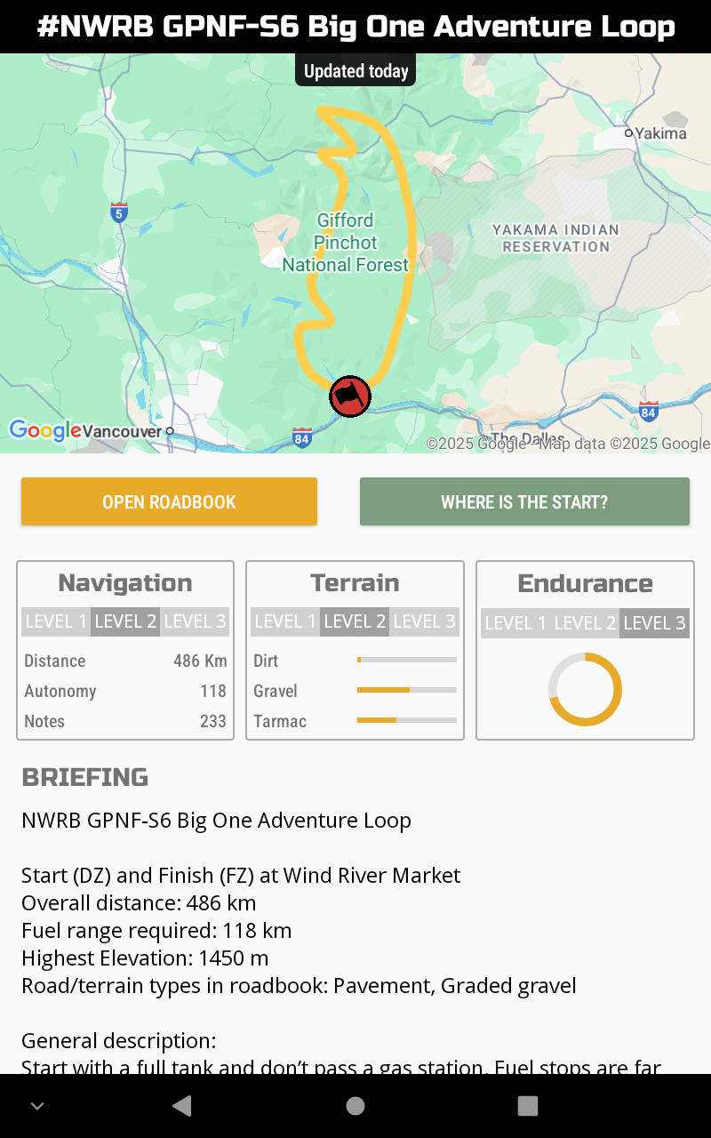
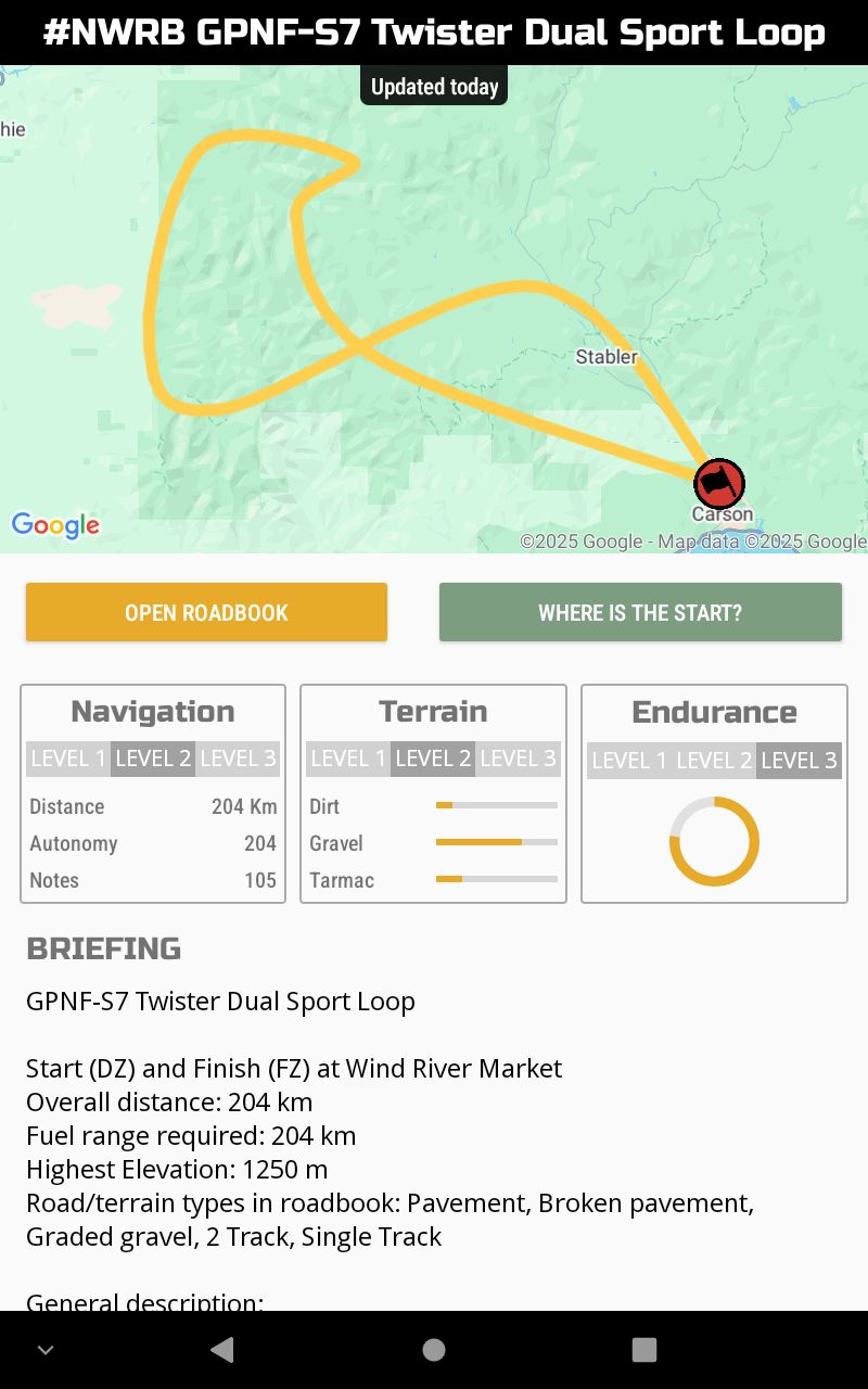
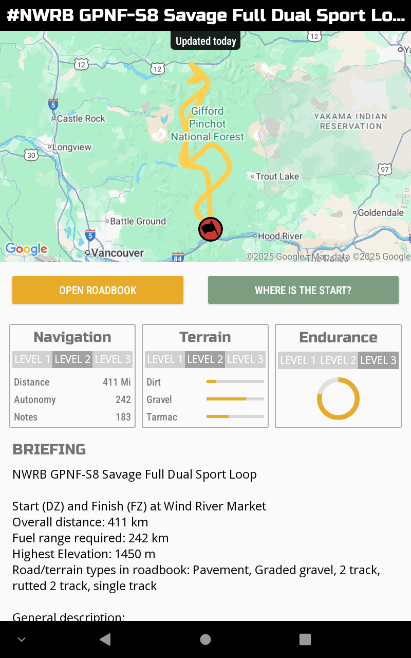
Saddle Mountain Nav Challenge Dual Sport Package
Start (DZ) and Finish (FZ) at Road R Staging
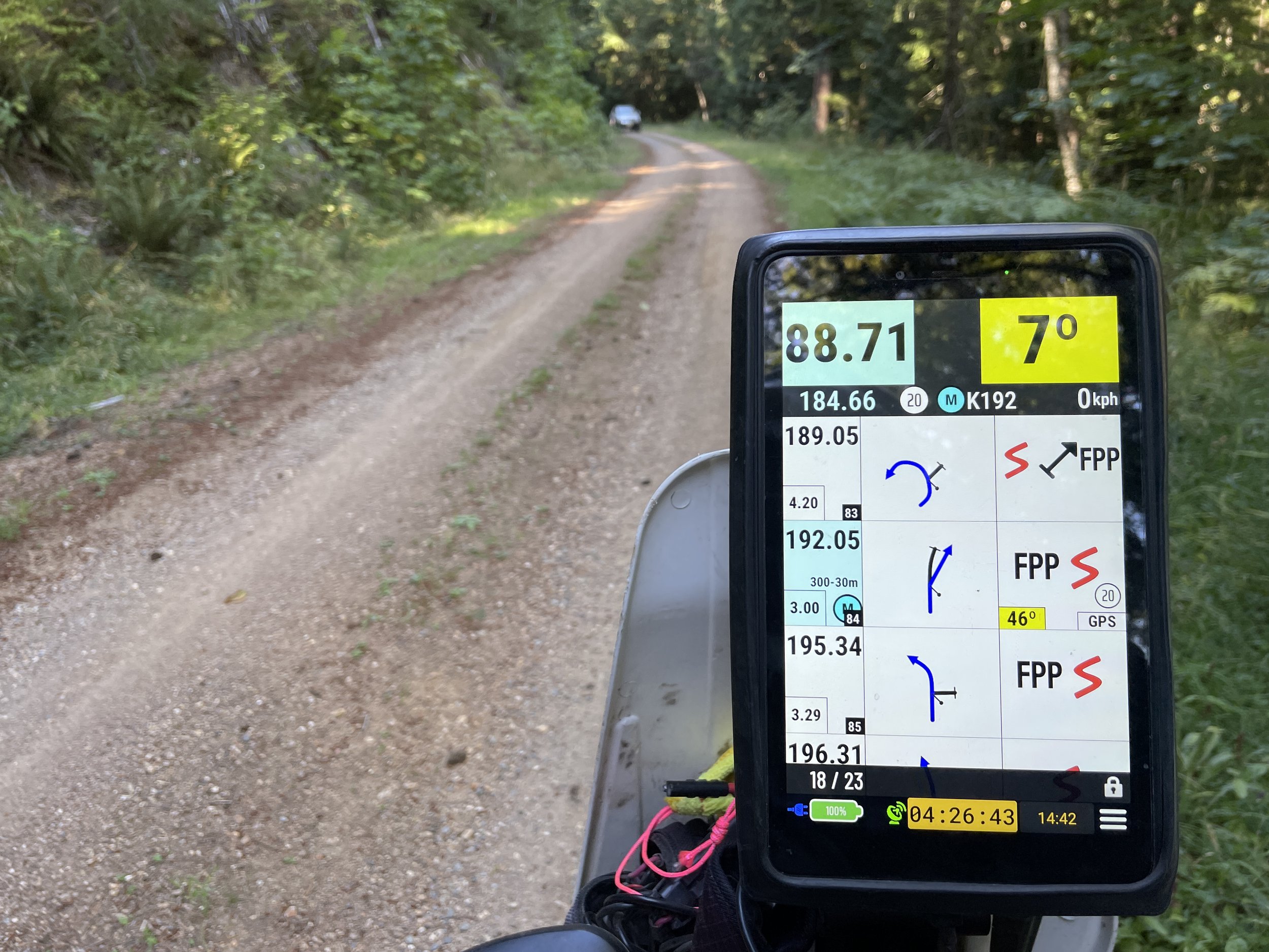
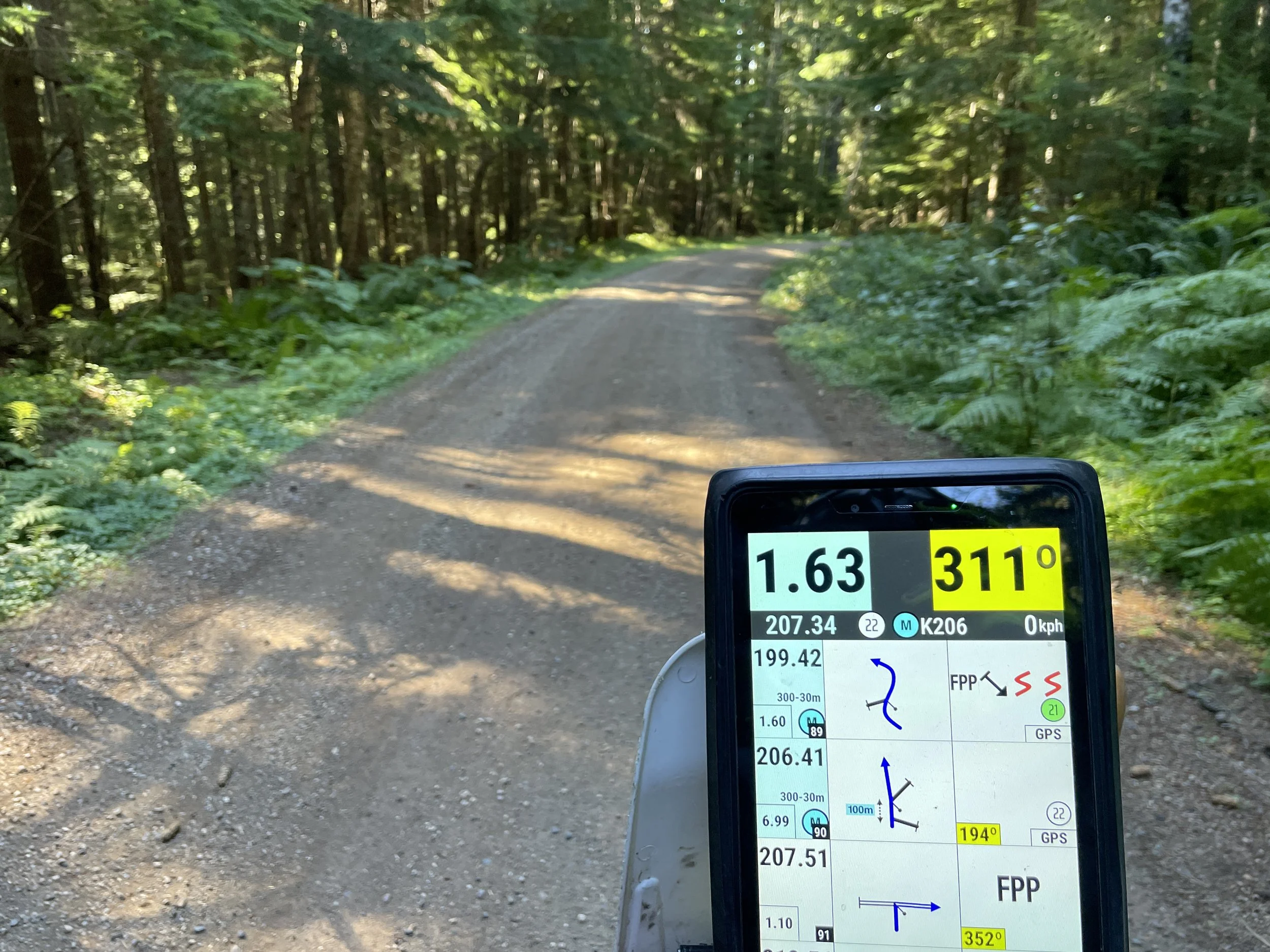
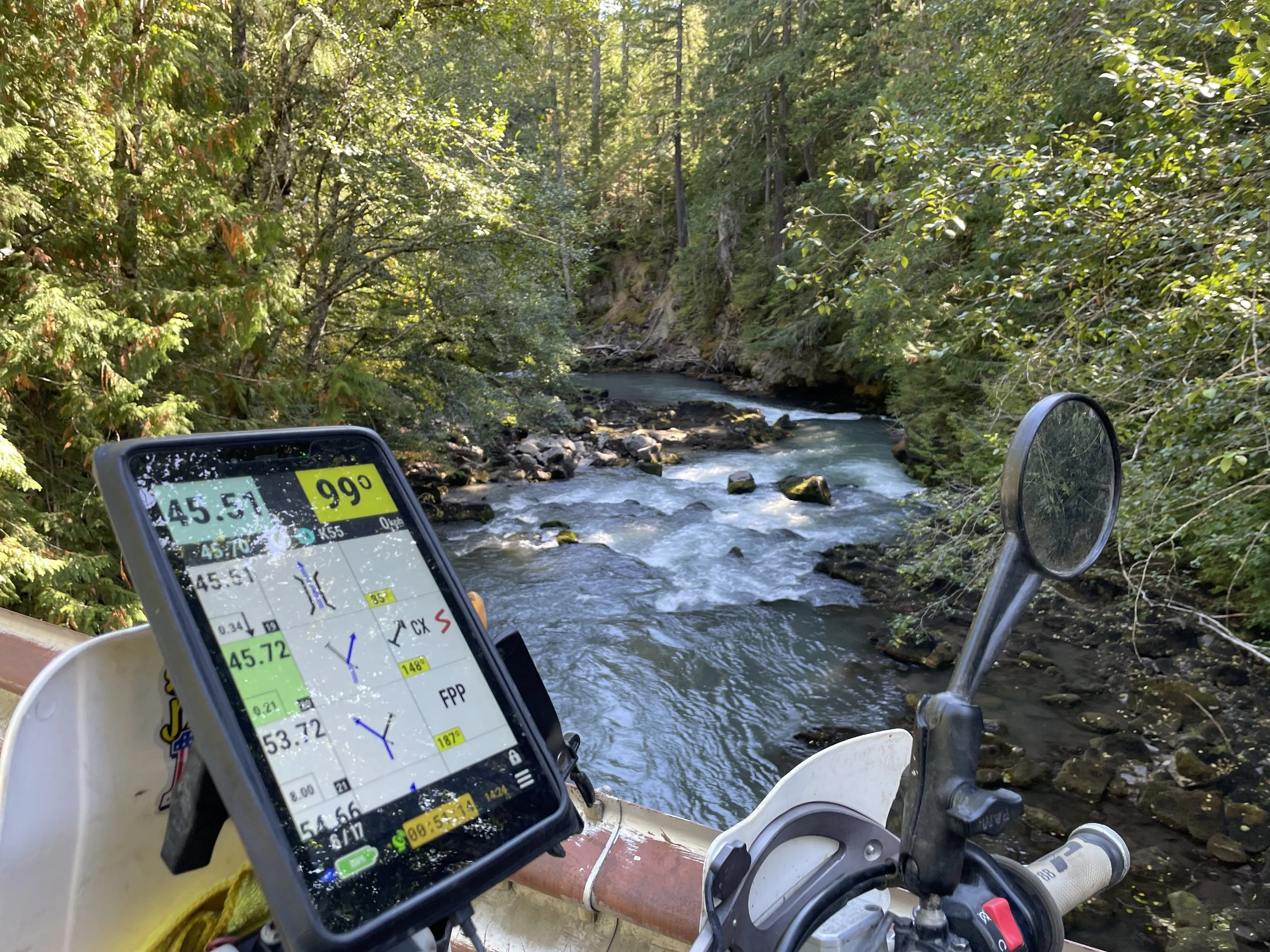
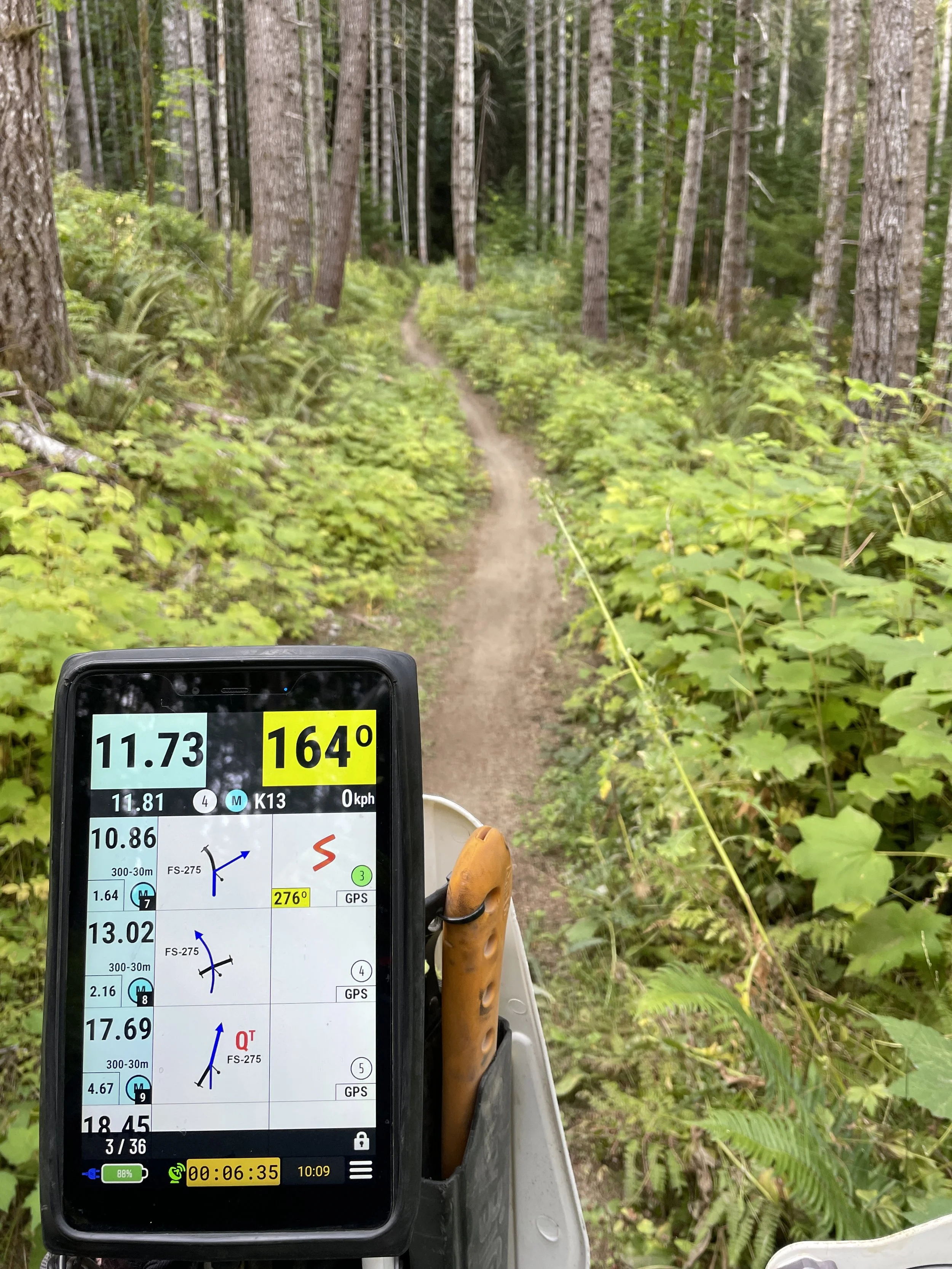
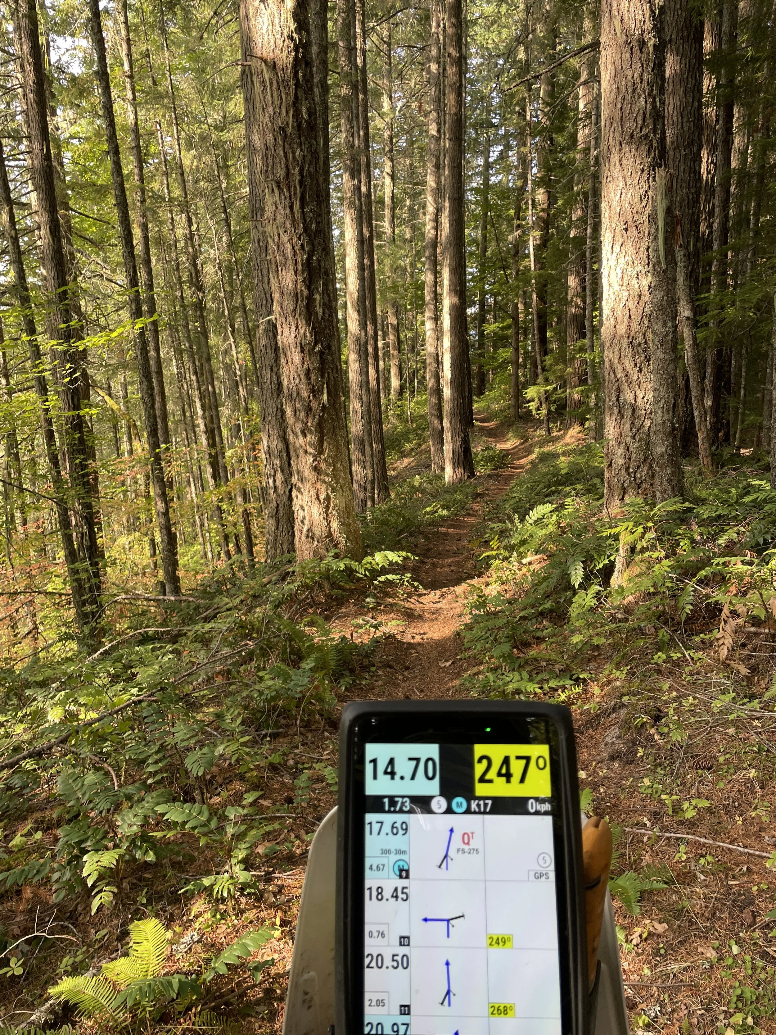
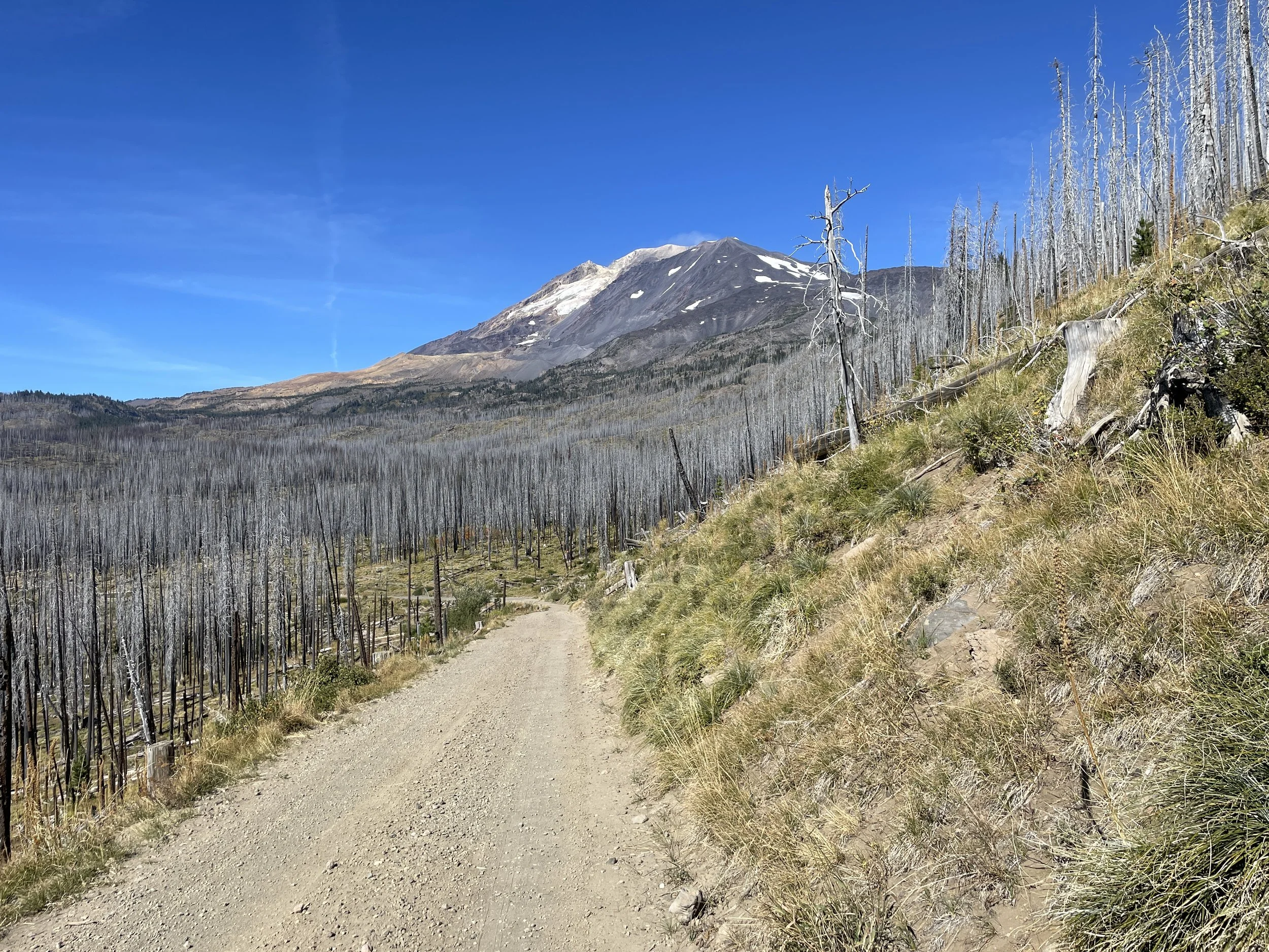
Road/terrain types in roadbook: Graded gravel, 2 Track, Singletrack, HP, rocks, ruts, sand, whoops, rocks, more rocks
General description:
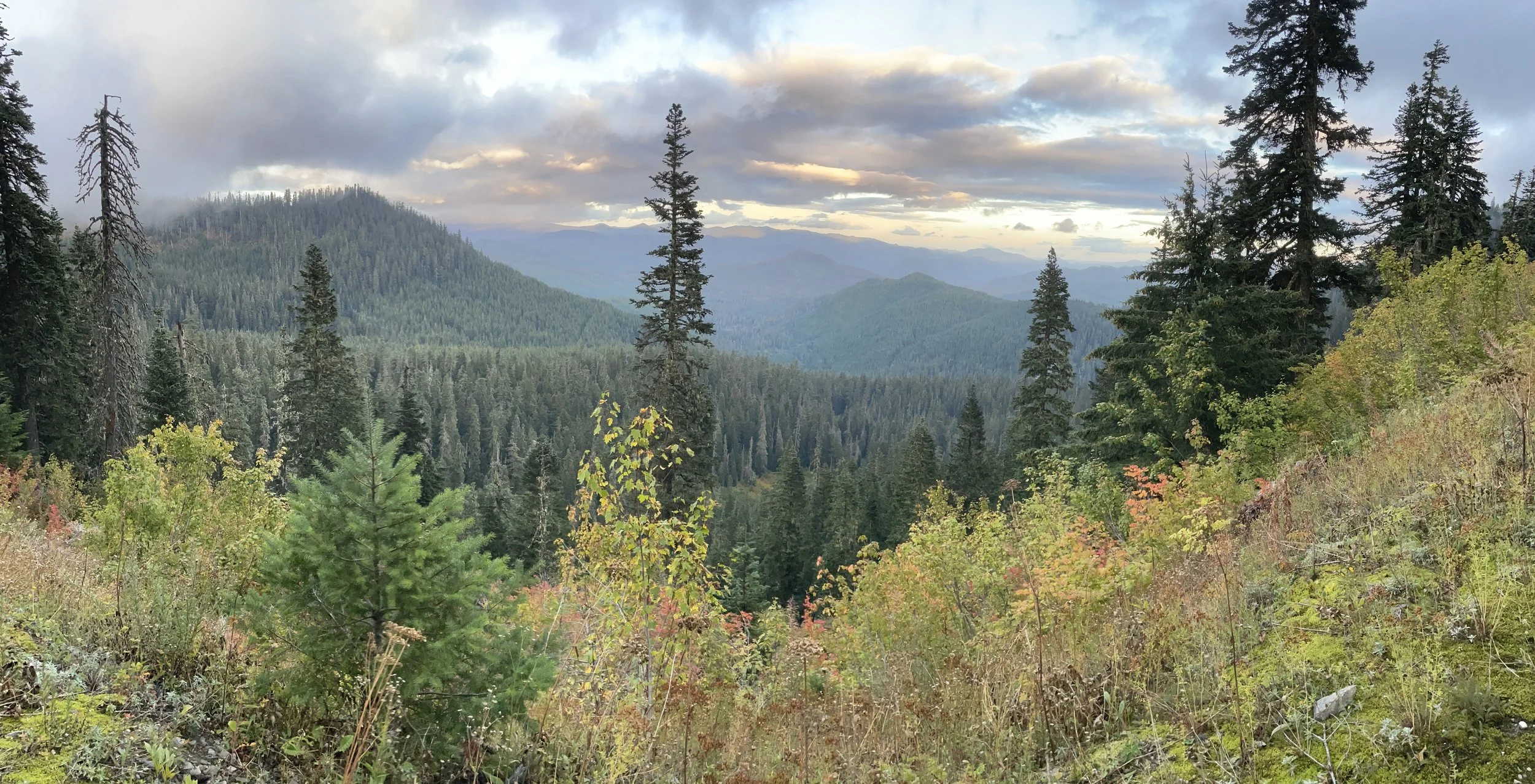
The Saddle Mountain Nav Challenge Dual Sport Package includes 3 Roadbook Tours in the Saddle Mountain ORV area. This area includes some surprisingly difficult terrain including steep sidehills, rocky climbs and descents, soft sandy climbs, exposure, whoops, steep climbs, sandy washes and deep canyons. These Roadbook Tours are recommended for more advanced riders on smaller Dual Sport bikes. They are primarily designed to challenge and improve navigation skills for riders who are planning to progress up to a major event with Roadbook Navigation. The routes cris-crosses the whole ORV area and will take you to places you haven’t been before.
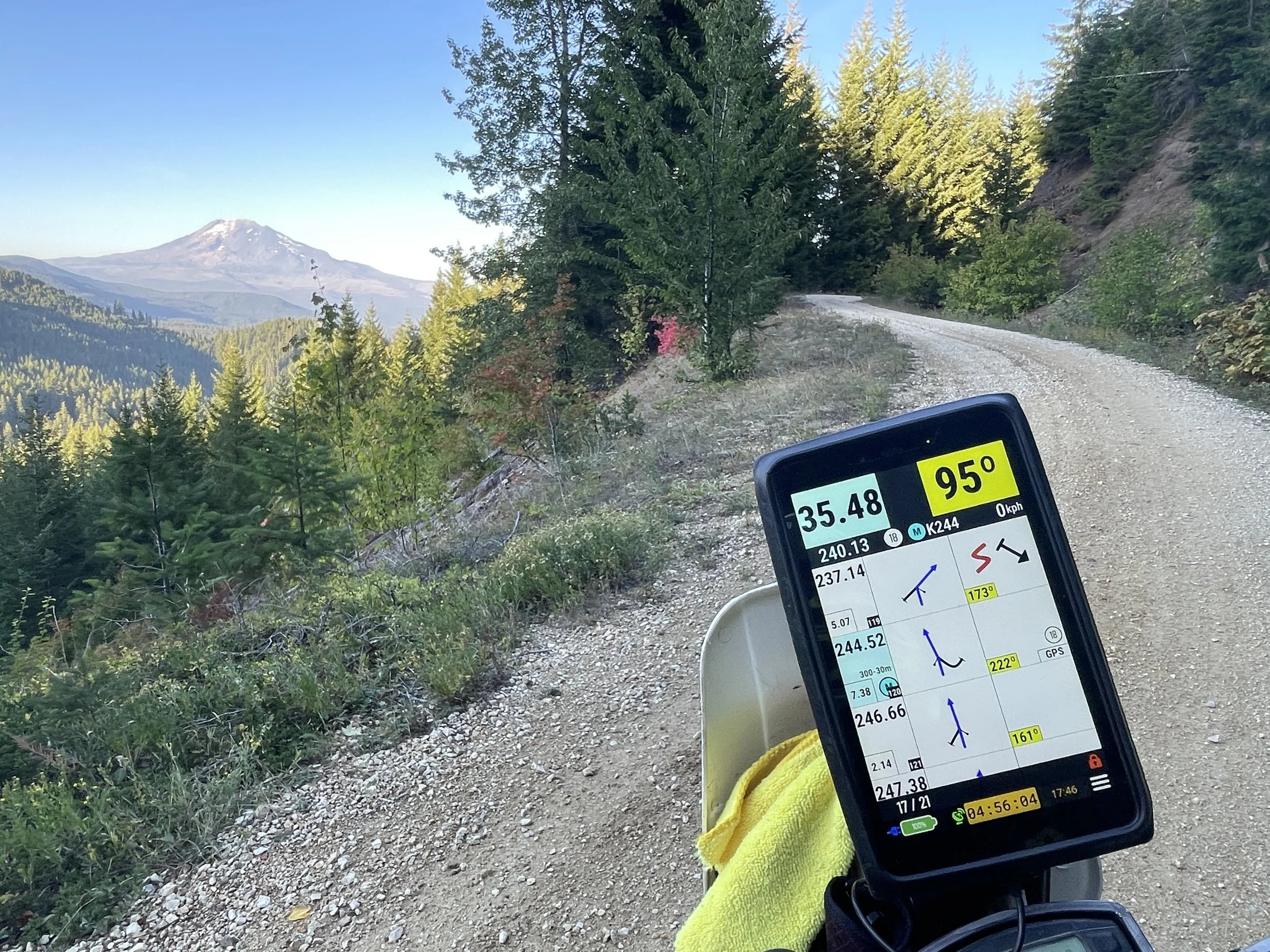
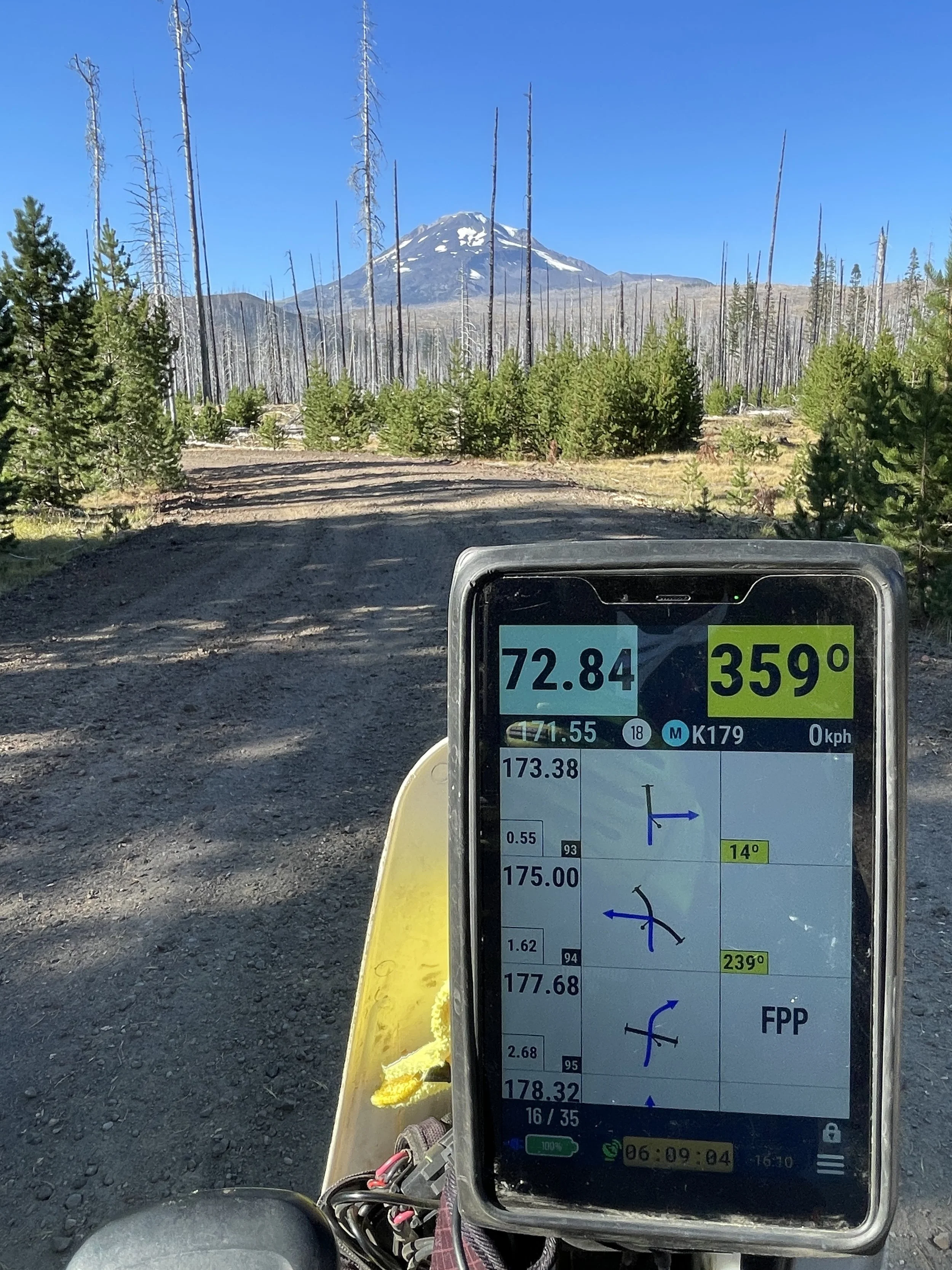
Consult the Blog Posts at www.NWRoadbooks.com for help with basic navigation and understanding waypoints.
Try to concentrate on making a clean run, not going fast.
This is NOT a race! No hazards are marked.
Boundaries around roadbook area: BLM – Saddle Mountain ORV area
The Saddle Mountain Nav Challenge Dual Sport Package includes the following Roadbook Tours:
Saddle Mountain-1 Nav Test
Start (DZ) and Finish (FZ) at Road R Staging
Overall distance: 33 km
Fuel range required: 33 km
Highest Elevation: 640 m
Road/terrain types in roadbook: Graded gravel, 2 Track, Singletrack, HP, rocks, ruts, sand, whoops, rocks, more rocks
General description:
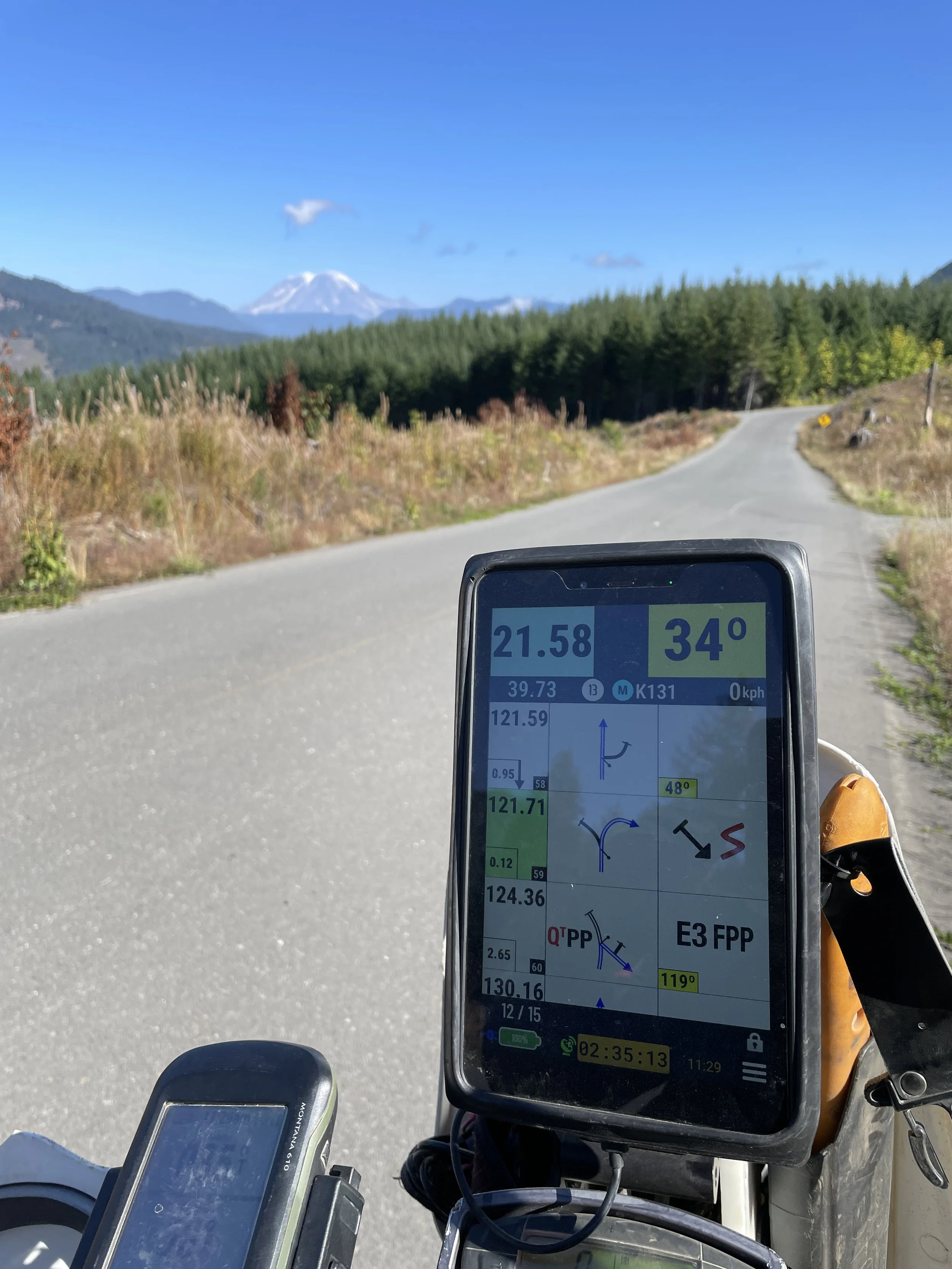
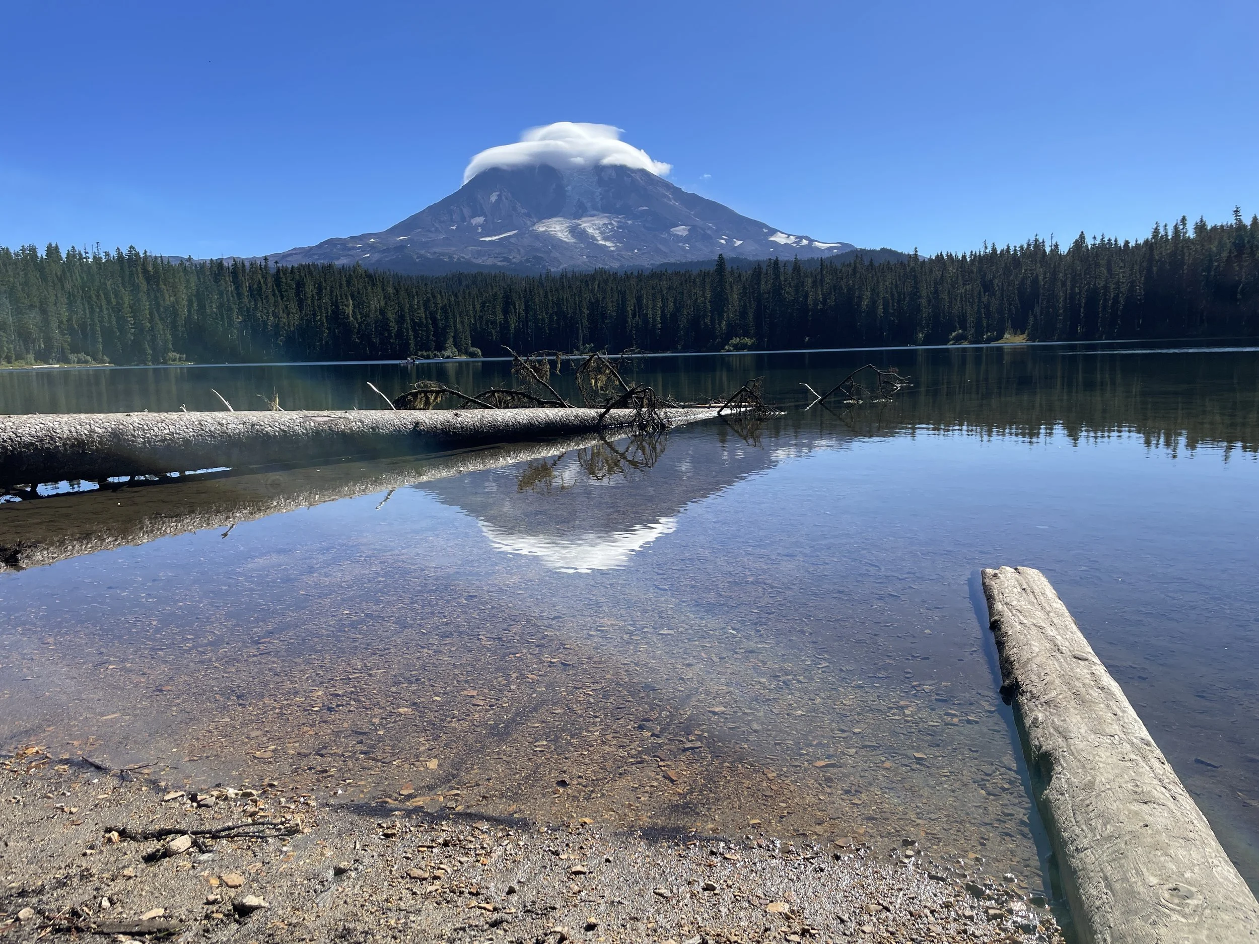
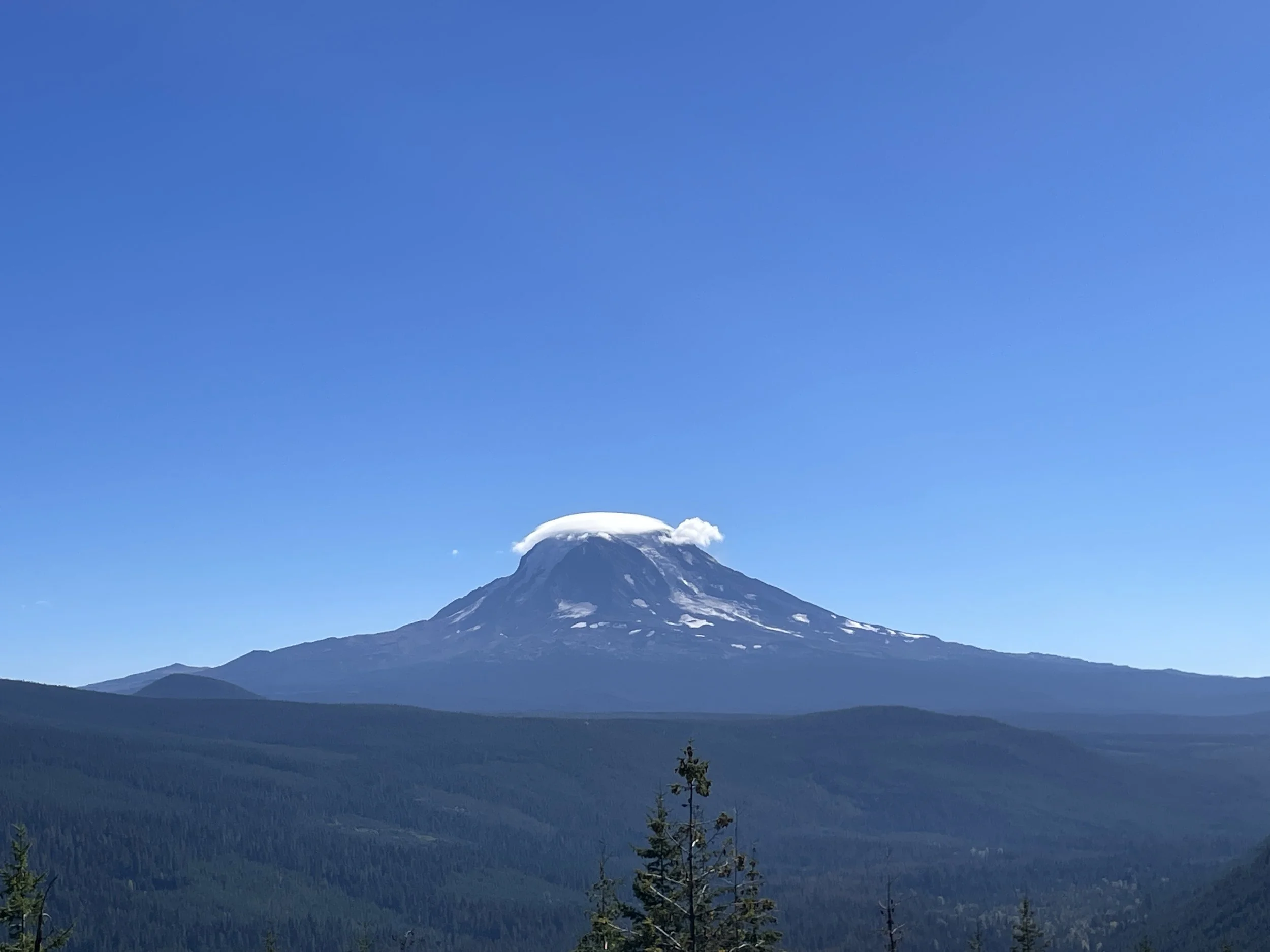
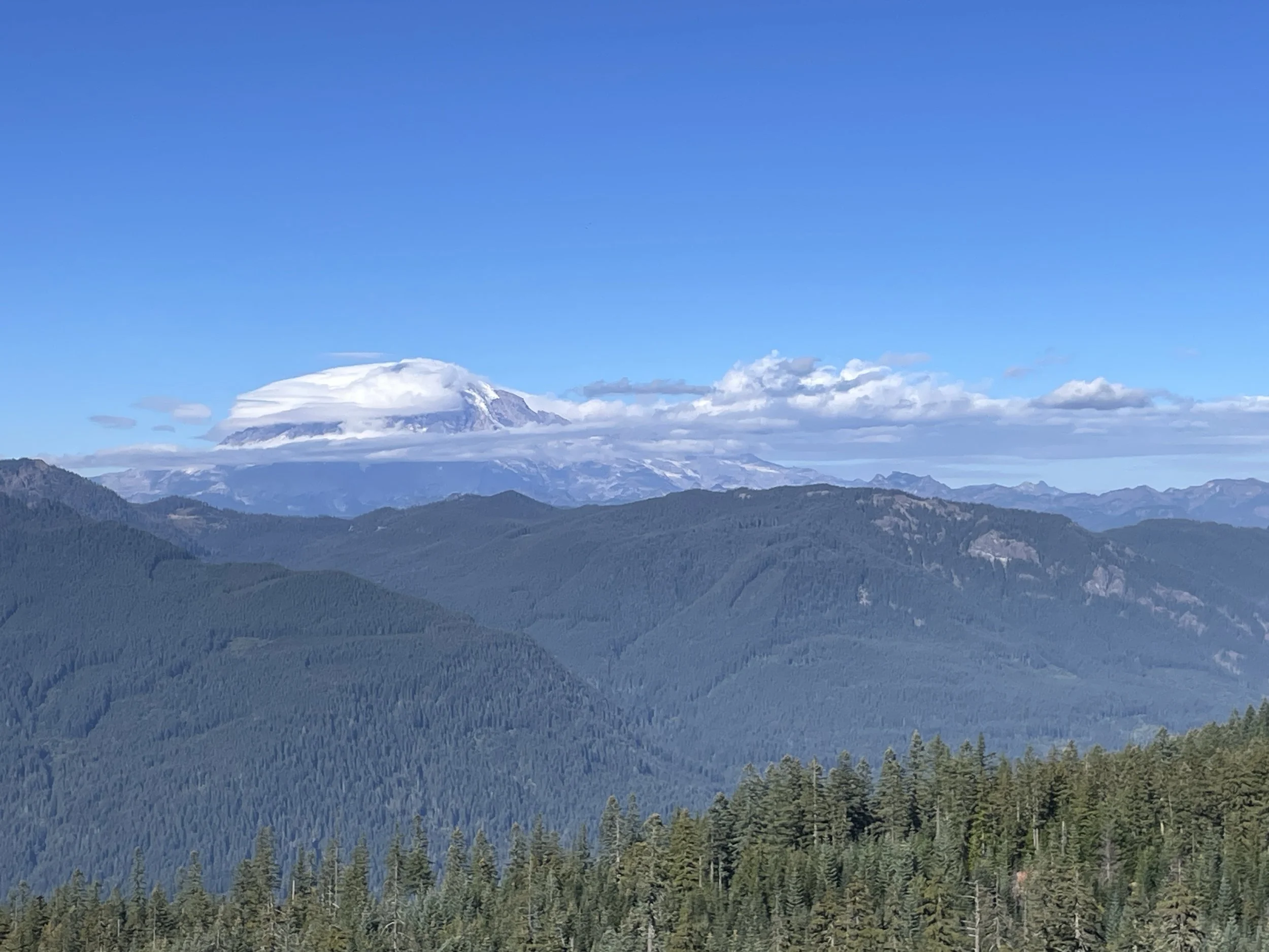
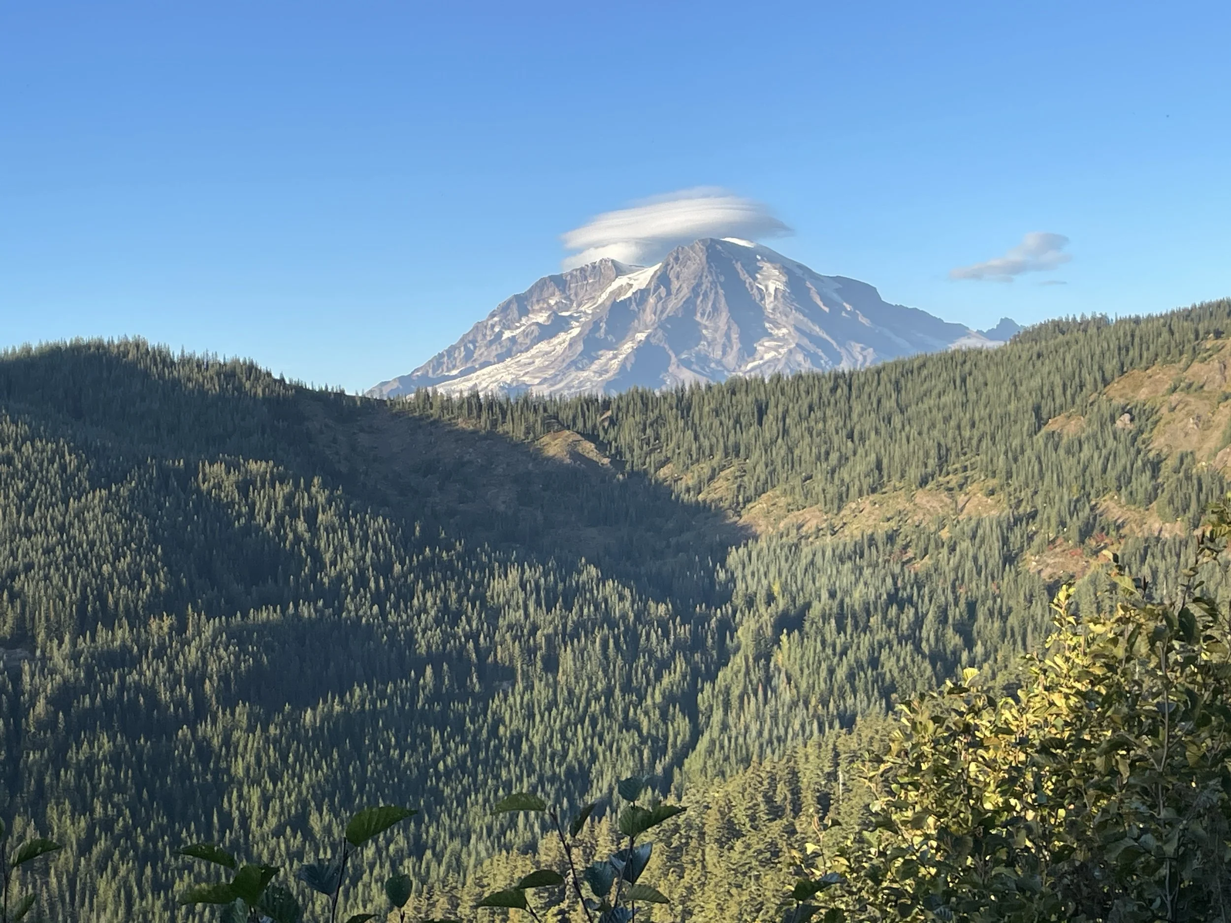
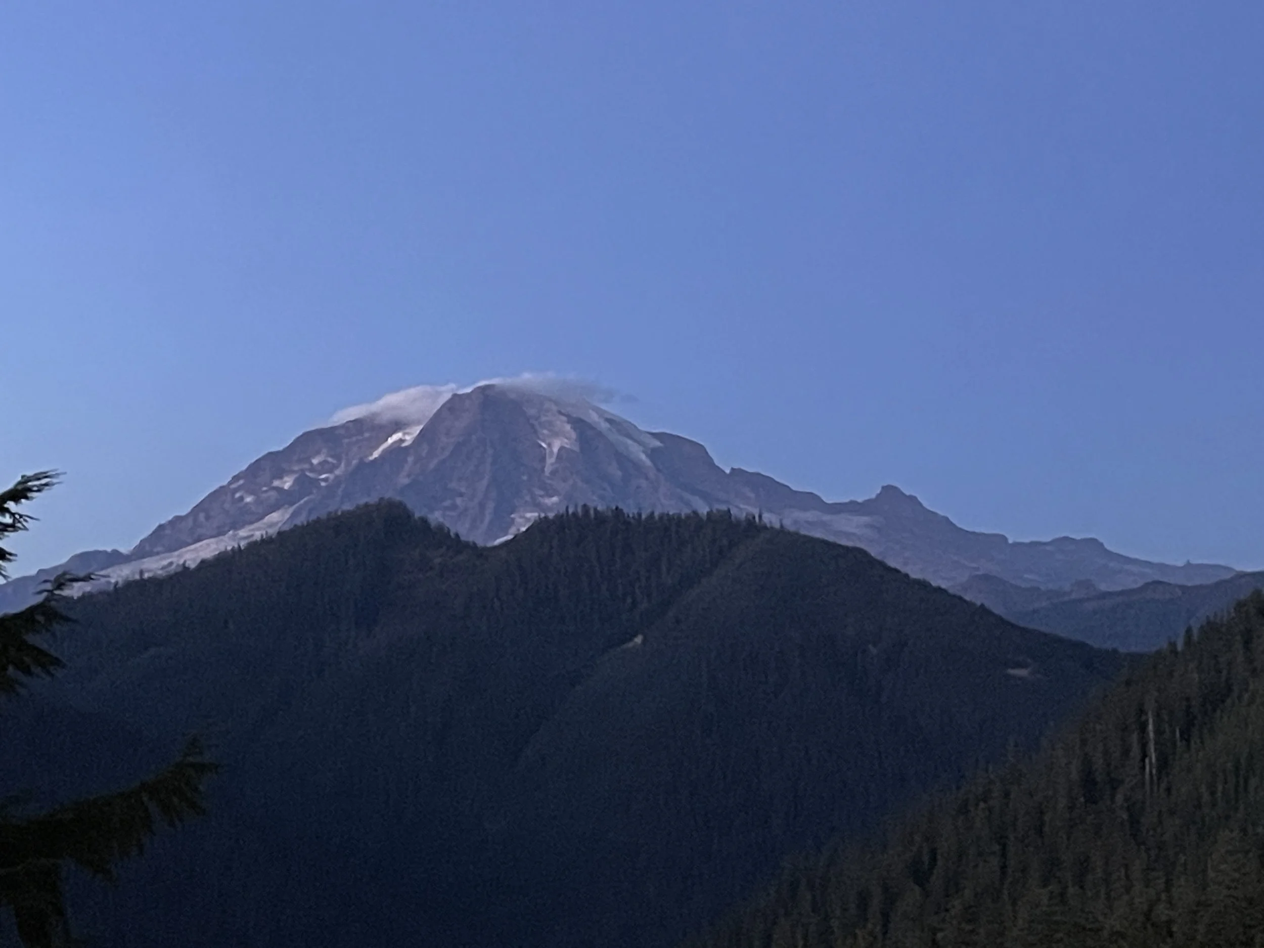
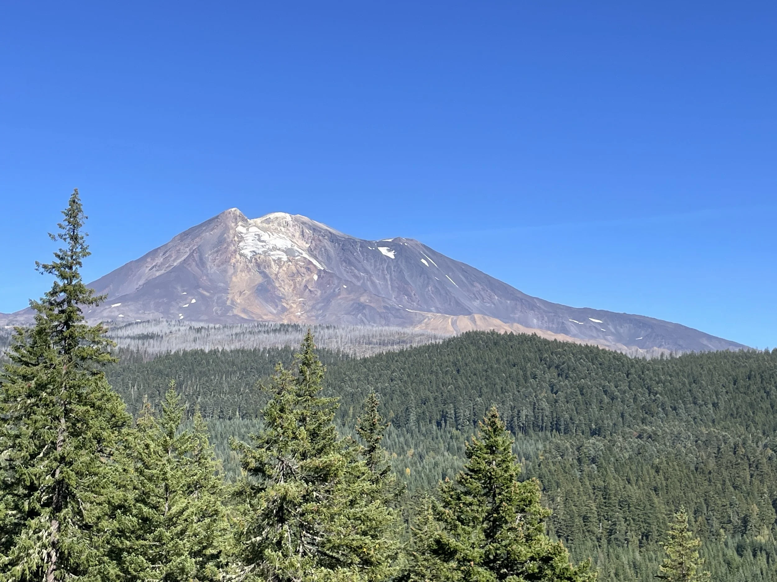
The Saddle Mountain Nav Test is best left for riders on smaller bikes. It is an advanced Roadbook Tour with a variety of terrain ranging from gravel road to no trail at all (HP). There is plenty of sand, rocks, whoops and dirt to tire you out. No pavement. Uphills, downhills, side hills, washes. This one has everything. We call it a Nav Test because it will test your navigation skills while exploring the Saddle Mountain open riding area which is full of varying terrain and a multitude of trails crisscrossing the whole area. Pay special attention to the notes to stay on track. This one will give you a chance to do some HP (off trail) navigation where you will follow your compass from note to note across who knows what is in the middle. Be sure to stop at the high points to enjoy views of the Columbia River, Crab Creek, and the whole Columbia Basin.
Saddle Mountain-2 High Points
Start (DZ) and Finish (FZ) at Road R Staging
Overall distance: 46 km
Fuel range required: 46 km
Highest Elevation: 640 m
Road/terrain types in roadbook: Graded gravel, 2 Track, Singletrack, HP, rocks, ruts, sand, washes, whoops, rocks, more rocks, more sand
General description:
The Saddle Mountain-2 High Points is best left for riders on smaller bikes. SM-2 High Points has more difficult terrain and navigation and builds upon what you learned in SM-1 Nav Test. The trails are tougher and the HP sections are longer.
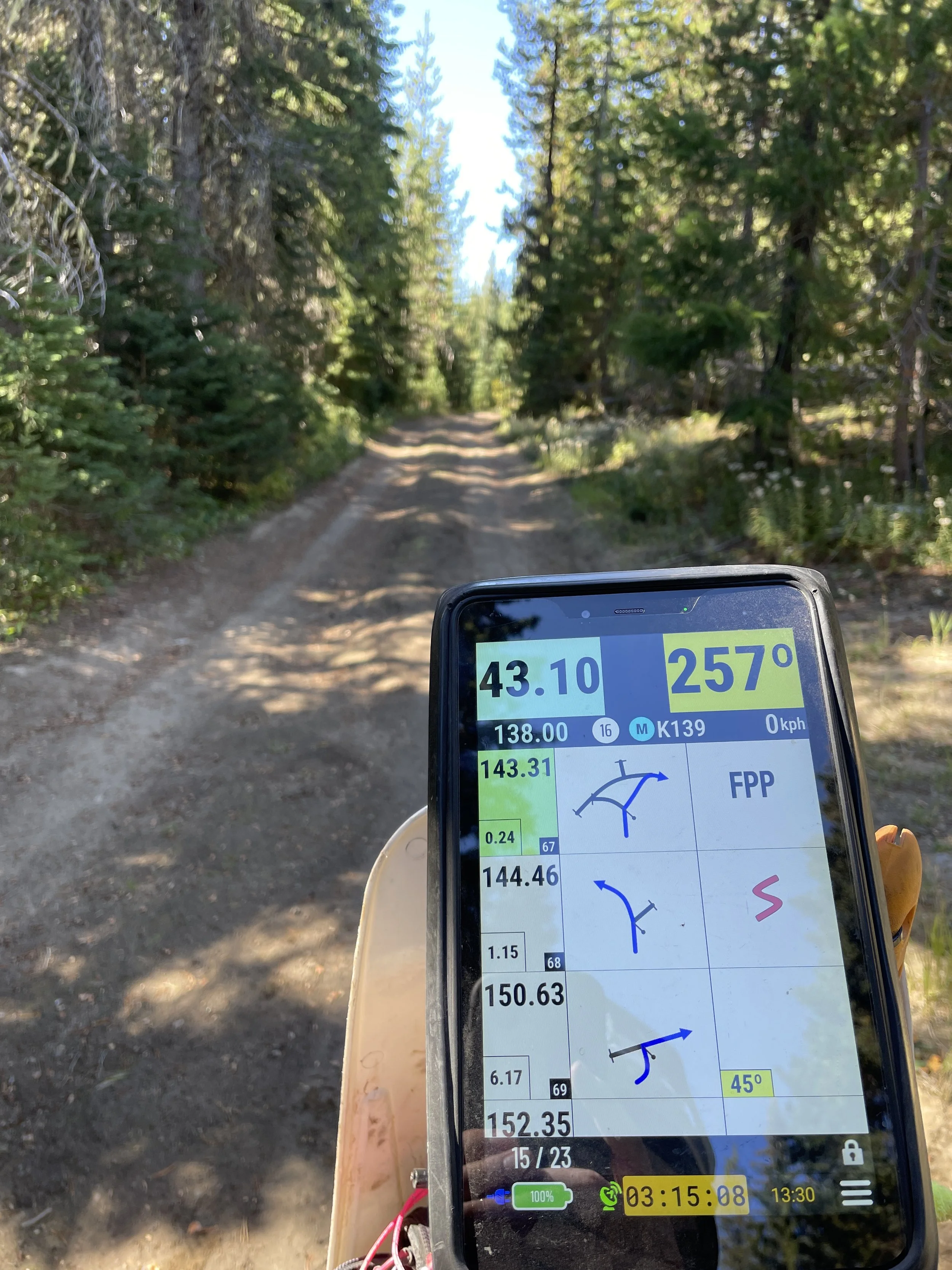
It is an advanced Roadbook Tour with a variety of terrain ranging from gravel road to no trail at all (HP). There is plenty of sand, rocks and dirt to tire you out. No pavement. Uphills, downhills, side hills, washes. This one has everything. It will take you to all corners of the riding area. You will ride some challenging terrain above the Columbia River and some other areas most riders never explore. You will navigate all over the Saddle Mountain open riding area which is full of varying terrain and a multitude of trails crisscrossing the whole area. Pay special attention to the notes to stay on track. This one will test you with some long HP (off trail) navigation where you follow your compass from note to note across who knows what is in the middle. On some of the HP sections, there will be obstacles to force you away from the most direct route to the next note. Be sure to stop at the high points to enjoy views of the Columbia River, Crab Creek, and the whole Columbia Basin.
It can be very challenging to stay on the correct compass heading in HP sections. Make sure you look up and find a landmark far off in the distance to use to stay on the right heading. Sometimes you may have to use more than one because you can’t see the horizon.
Remember there are NO hazards marked in HP sections. Ride at a slower pace, watch where you are going and keep your eyes up.
Saddle Mountain-3 Dot to Dot
Start (DZ) and Finish (FZ) at Road R Staging
Overall distance: 26 km
Fuel range required: 26 km
Highest Elevation: 640 m
Road/terrain types in roadbook: Graded gravel, 2 Track, Singletrack, HP
General description:
The Saddle Mountain-3 Dot to Dot is best left for riders on smaller bikes. While it is only 26 km and a dozen notes long, it is a tough one. It is an advanced Roadbook Tour comprised almost entirely of Off-Trail (HP) navigation. It will be a real challenge to complete. Almost every HP section will have some sort of obstacle you will be forced to go around. When you complete this it will be a real accomplishment.
The Saddle Mountain ORV area has plenty of sand, rocks and dirt to tire you out. Uphills, downhills, side hills, washes. This one has everything. And all of it will be in your way while trying to get from one note to the next. The Saddle Dot to Dot will have you navigating the entire Saddle Mountain open riding area which is full of varying terrain like canyons and steep grades crisscrossing the whole area. Be sure to stop at the high points to enjoy views of the Columbia River, Crab Creek, and the whole Columbia Basin.
It can be very challenging to stay on the correct compass heading in HP sections. Make sure you look up and find a landmark far off in the distance to use to stay on the right heading. Sometimes you may have to use more than one because you can’t see the horizon.
Saddle Mountain Nav Challenge Dual Sport Package
Start (DZ) and Finish (FZ) at Road R Staging
Road/terrain types in roadbook: Graded gravel, 2 Track, Singletrack, HP, rocks, ruts, sand, whoops, rocks, more rocks
General description:
The Saddle Mountain Nav Challenge Dual Sport Package includes 3 Roadbook Tours in the Saddle Mountain ORV area. This area includes some surprisingly difficult terrain including steep sidehills, rocky climbs and descents, soft sandy climbs, exposure, whoops, steep climbs, sandy washes and deep canyons. These Roadbook Tours are recommended for more advanced riders on smaller Dual Sport bikes. They are primarily designed to challenge and improve navigation skills for riders who are planning to progress up to a major event with Roadbook Navigation. The routes cris-crosses the whole ORV area and will take you to places you haven’t been before.
Consult the Blog Posts at www.NWRoadbooks.com for help with basic navigation and understanding waypoints.
Try to concentrate on making a clean run, not going fast.
This is NOT a race! No hazards are marked.
Boundaries around roadbook area: BLM – Saddle Mountain ORV area
The Saddle Mountain Nav Challenge Dual Sport Package includes the following Roadbook Tours:
Saddle Mountain-1 Nav Test
Start (DZ) and Finish (FZ) at Road R Staging
Overall distance: 33 km
Fuel range required: 33 km
Highest Elevation: 640 m
Road/terrain types in roadbook: Graded gravel, 2 Track, Singletrack, HP, rocks, ruts, sand, whoops, rocks, more rocks
General description:
The Saddle Mountain Nav Test is best left for riders on smaller bikes. It is an advanced Roadbook Tour with a variety of terrain ranging from gravel road to no trail at all (HP). There is plenty of sand, rocks, whoops and dirt to tire you out. No pavement. Uphills, downhills, side hills, washes. This one has everything. We call it a Nav Test because it will test your navigation skills while exploring the Saddle Mountain open riding area which is full of varying terrain and a multitude of trails crisscrossing the whole area. Pay special attention to the notes to stay on track. This one will give you a chance to do some HP (off trail) navigation where you will follow your compass from note to note across who knows what is in the middle. Be sure to stop at the high points to enjoy views of the Columbia River, Crab Creek, and the whole Columbia Basin.
Saddle Mountain-2 High Points
Start (DZ) and Finish (FZ) at Road R Staging
Overall distance: 46 km
Fuel range required: 46 km
Highest Elevation: 640 m
Road/terrain types in roadbook: Graded gravel, 2 Track, Singletrack, HP, rocks, ruts, sand, washes, whoops, rocks, more rocks, more sand
General description:
The Saddle Mountain-2 High Points is best left for riders on smaller bikes. SM-2 High Points has more difficult terrain and navigation and builds upon what you learned in SM-1 Nav Test. The trails are tougher and the HP sections are longer.
It is an advanced Roadbook Tour with a variety of terrain ranging from gravel road to no trail at all (HP). There is plenty of sand, rocks and dirt to tire you out. No pavement. Uphills, downhills, side hills, washes. This one has everything. It will take you to all corners of the riding area. You will ride some challenging terrain above the Columbia River and some other areas most riders never explore. You will navigate all over the Saddle Mountain open riding area which is full of varying terrain and a multitude of trails crisscrossing the whole area. Pay special attention to the notes to stay on track. This one will test you with some long HP (off trail) navigation where you follow your compass from note to note across who knows what is in the middle. On some of the HP sections, there will be obstacles to force you away from the most direct route to the next note. Be sure to stop at the high points to enjoy views of the Columbia River, Crab Creek, and the whole Columbia Basin.
It can be very challenging to stay on the correct compass heading in HP sections. Make sure you look up and find a landmark far off in the distance to use to stay on the right heading. Sometimes you may have to use more than one because you can’t see the horizon.
Remember there are NO hazards marked in HP sections. Ride at a slower pace, watch where you are going and keep your eyes up.
Saddle Mountain-3 Dot to Dot
Start (DZ) and Finish (FZ) at Road R Staging
Overall distance: 26 km
Fuel range required: 26 km
Highest Elevation: 640 m
Road/terrain types in roadbook: Graded gravel, 2 Track, Singletrack, HP
General description:
The Saddle Mountain-3 Dot to Dot is best left for riders on smaller bikes. While it is only 26 km and a dozen notes long, it is a tough one. It is an advanced Roadbook Tour comprised almost entirely of Off-Trail (HP) navigation. It will be a real challenge to complete. Almost every HP section will have some sort of obstacle you will be forced to go around. When you complete this it will be a real accomplishment.
The Saddle Mountain ORV area has plenty of sand, rocks and dirt to tire you out. Uphills, downhills, side hills, washes. This one has everything. And all of it will be in your way while trying to get from one note to the next. The Saddle Dot to Dot will have you navigating the entire Saddle Mountain open riding area which is full of varying terrain like canyons and steep grades crisscrossing the whole area. Be sure to stop at the high points to enjoy views of the Columbia River, Crab Creek, and the whole Columbia Basin.
It can be very challenging to stay on the correct compass heading in HP sections. Make sure you look up and find a landmark far off in the distance to use to stay on the right heading. Sometimes you may have to use more than one because you can’t see the horizon.
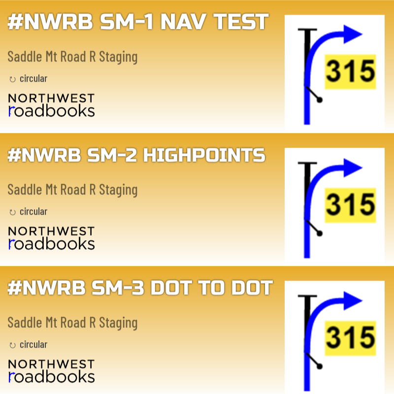 Image 1 of 11
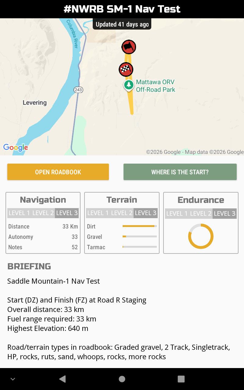 Image 2 of 11
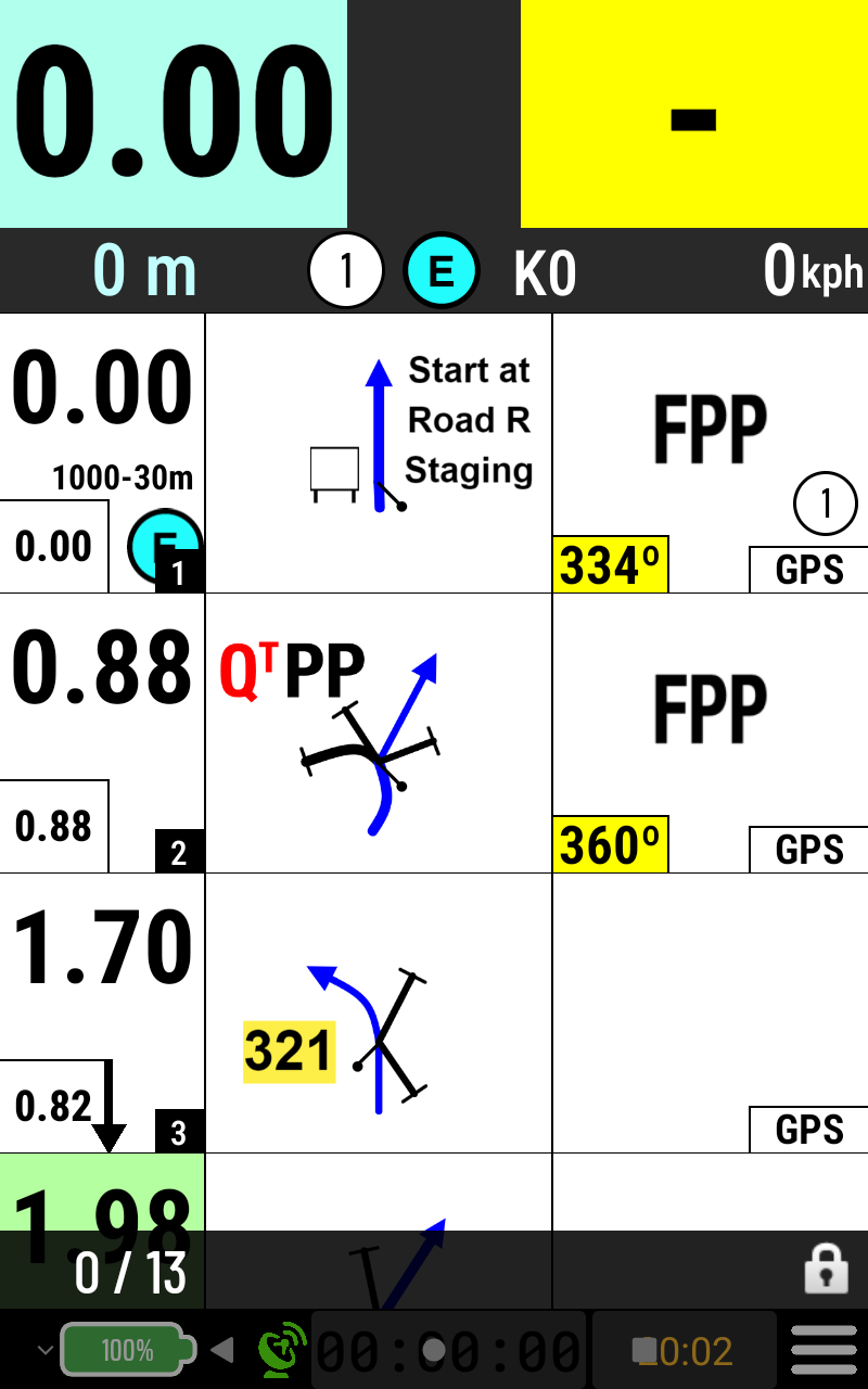 Image 3 of 11
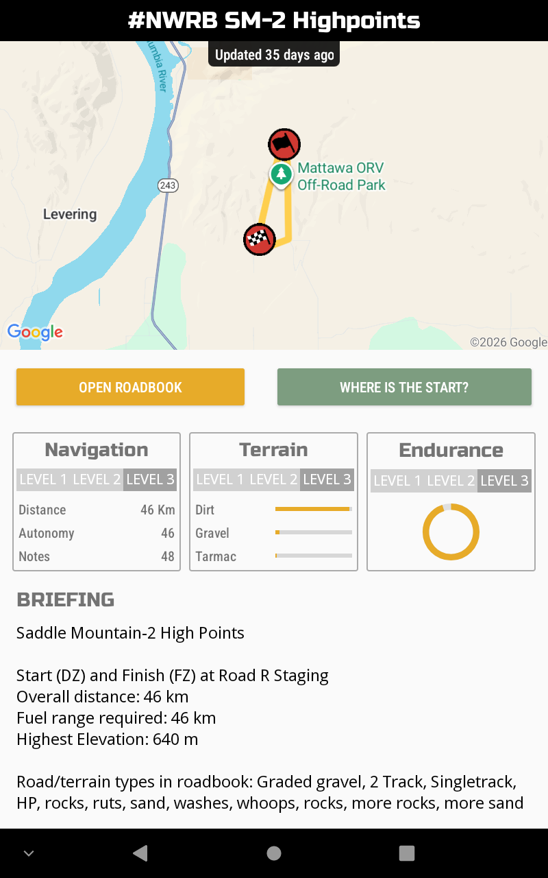 Image 4 of 11
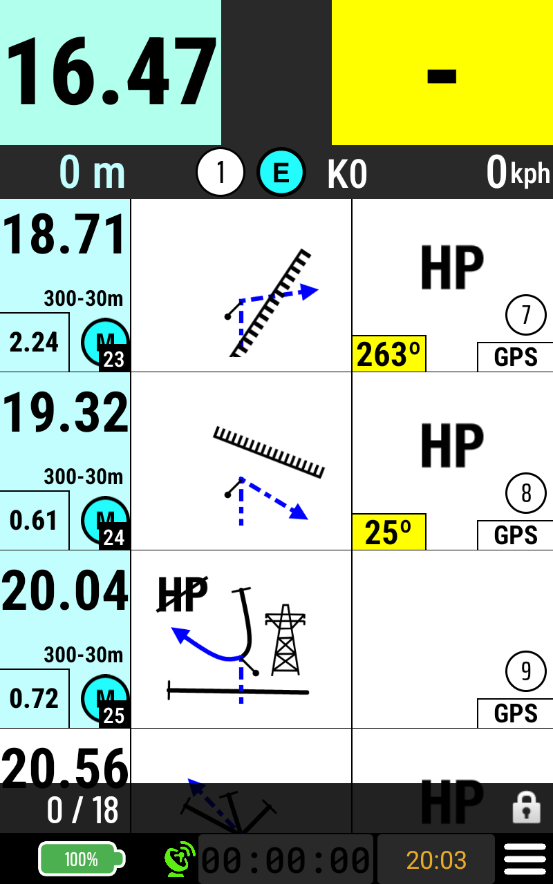 Image 5 of 11
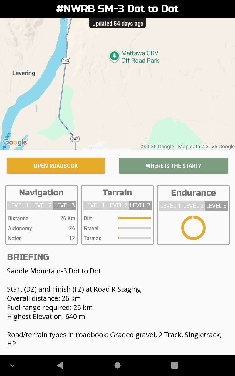 Image 6 of 11
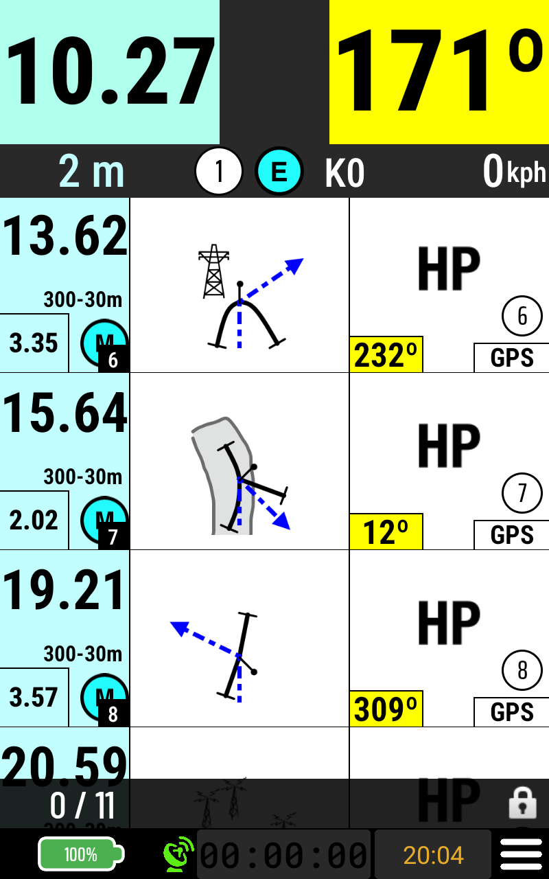 Image 7 of 11
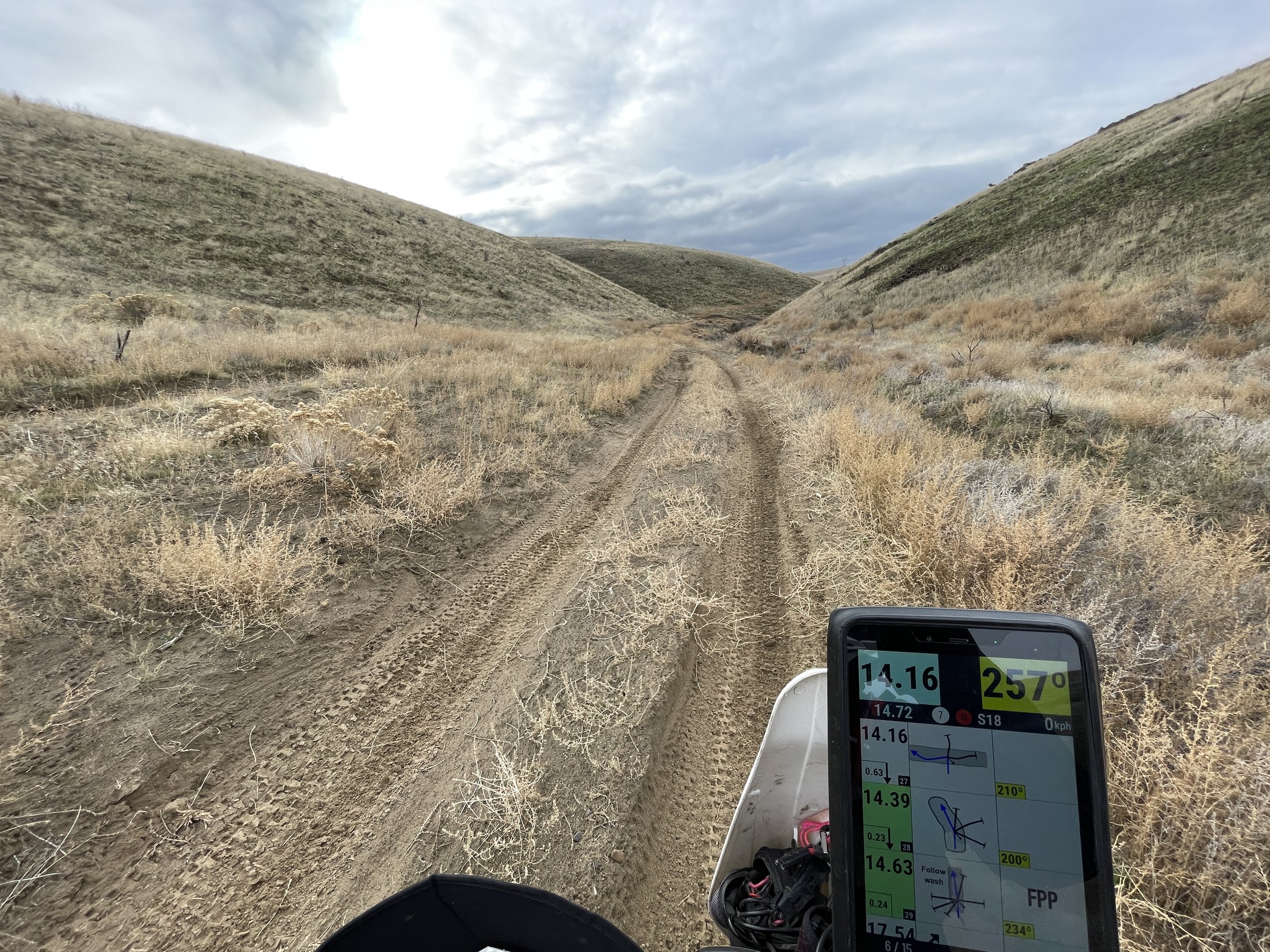 Image 8 of 11
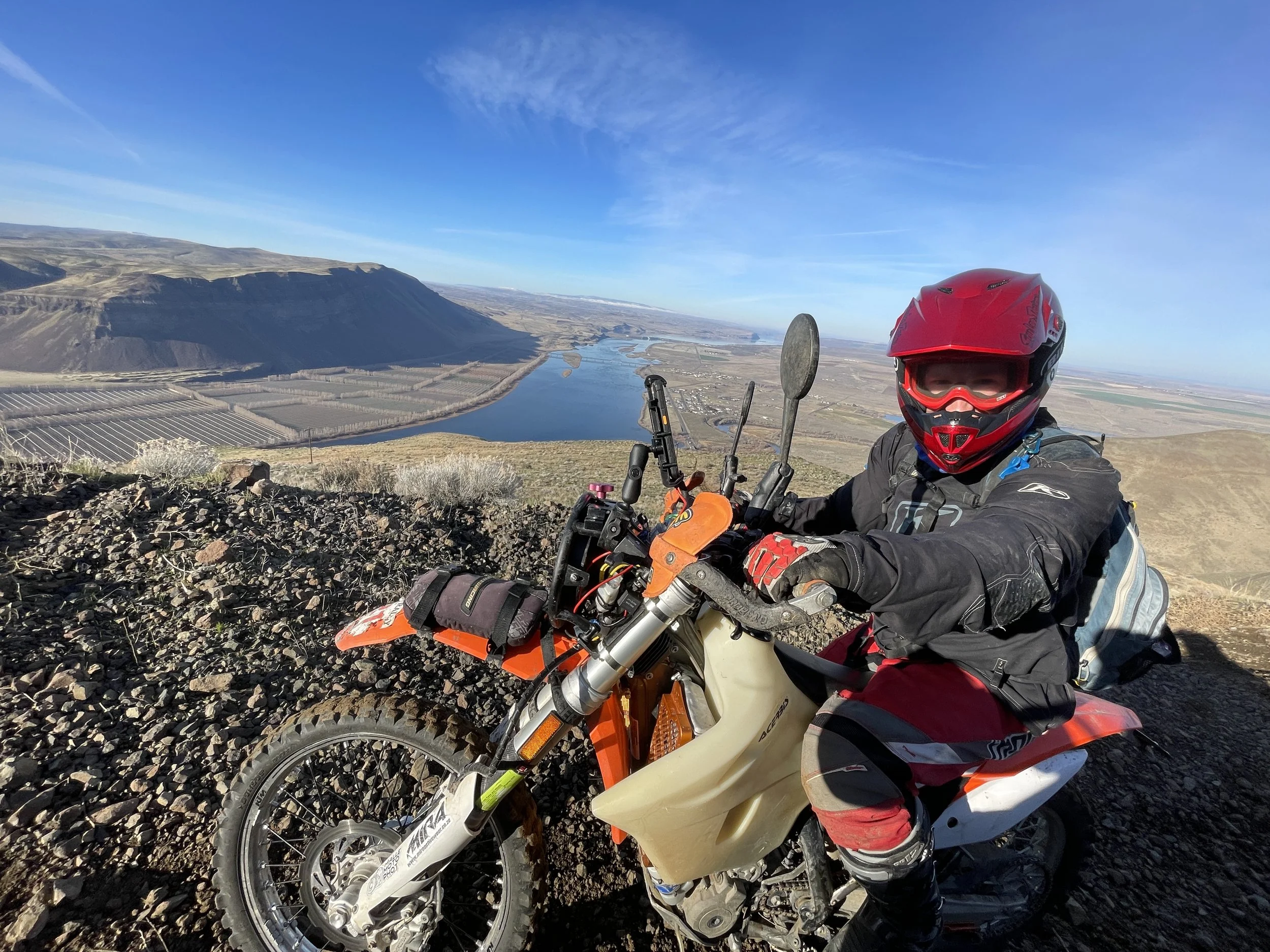 Image 9 of 11
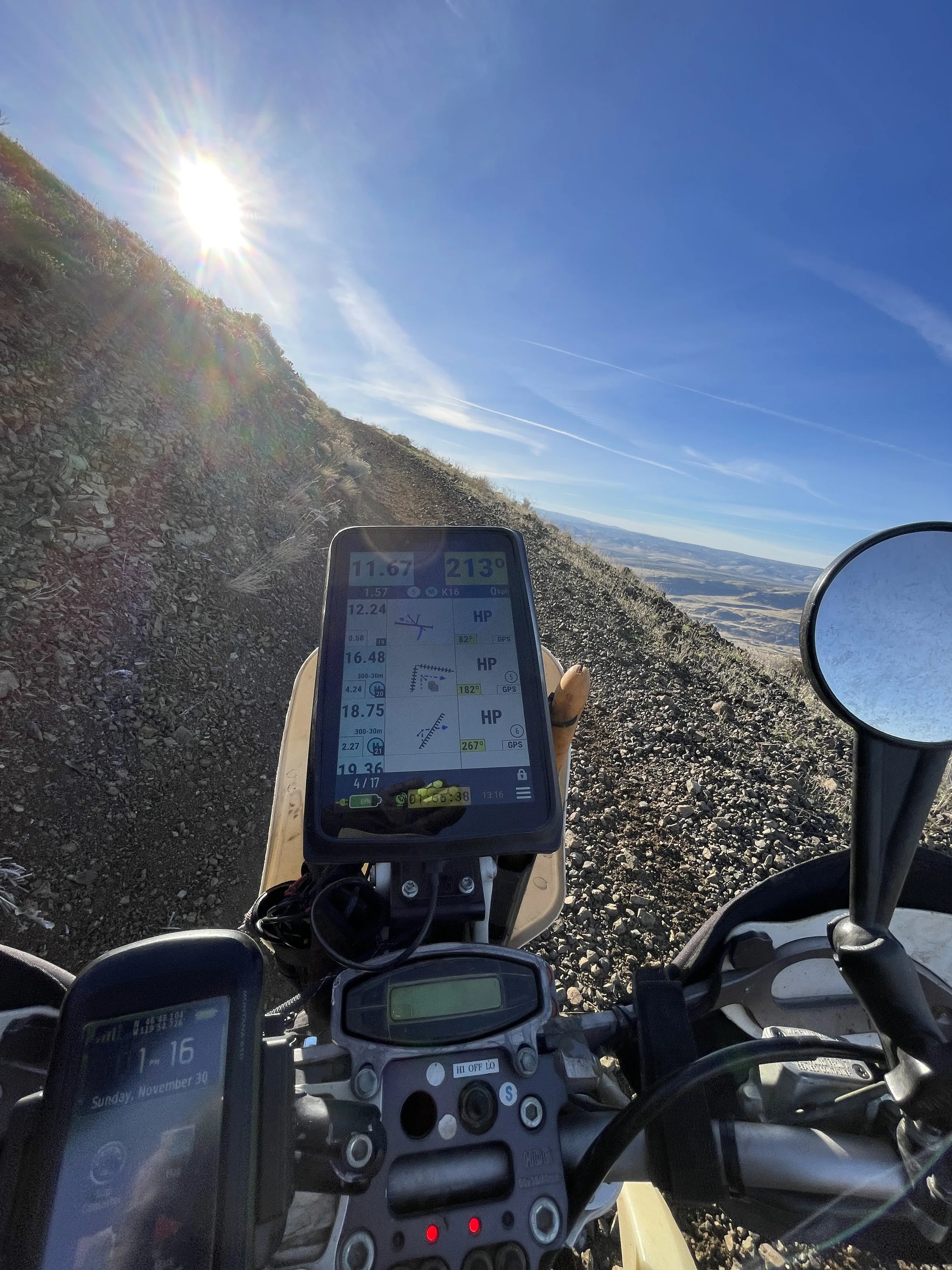 Image 10 of 11
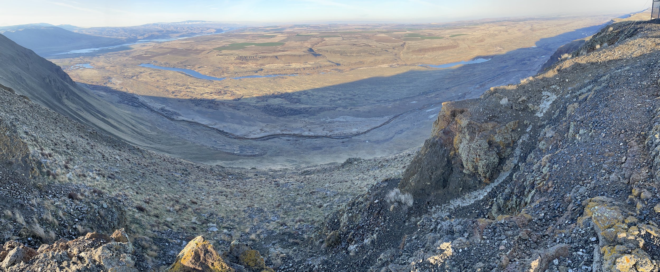 Image 11 of 11