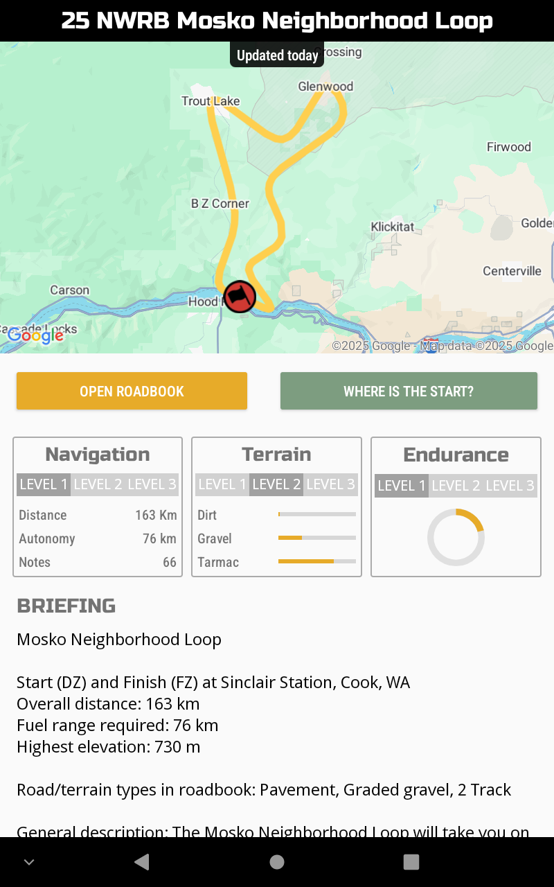
NWRB GPNF-North Roadbook Tour Collection
Start (DZ) and Finish (FZ) at Randle 76 Station
Total distance: 1650 km
Road/terrain types in roadbook: Pavement, Graded gravel, 2 Track, Overgrown 2 Track, Rough 2 Track, Single Track
General description:
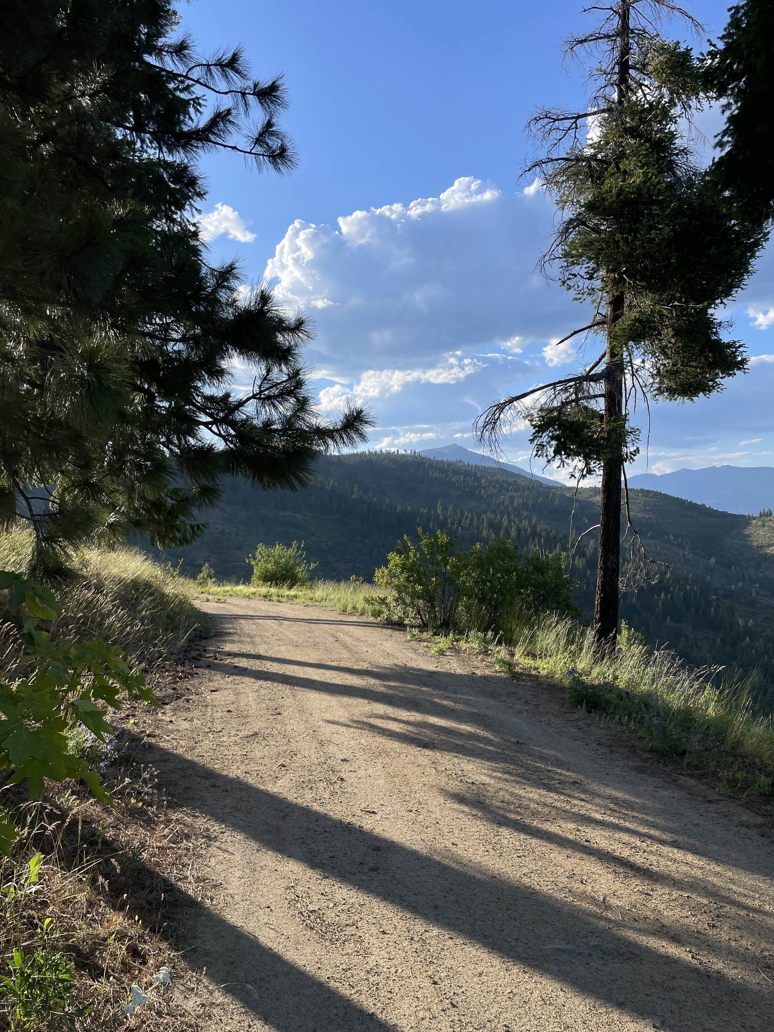
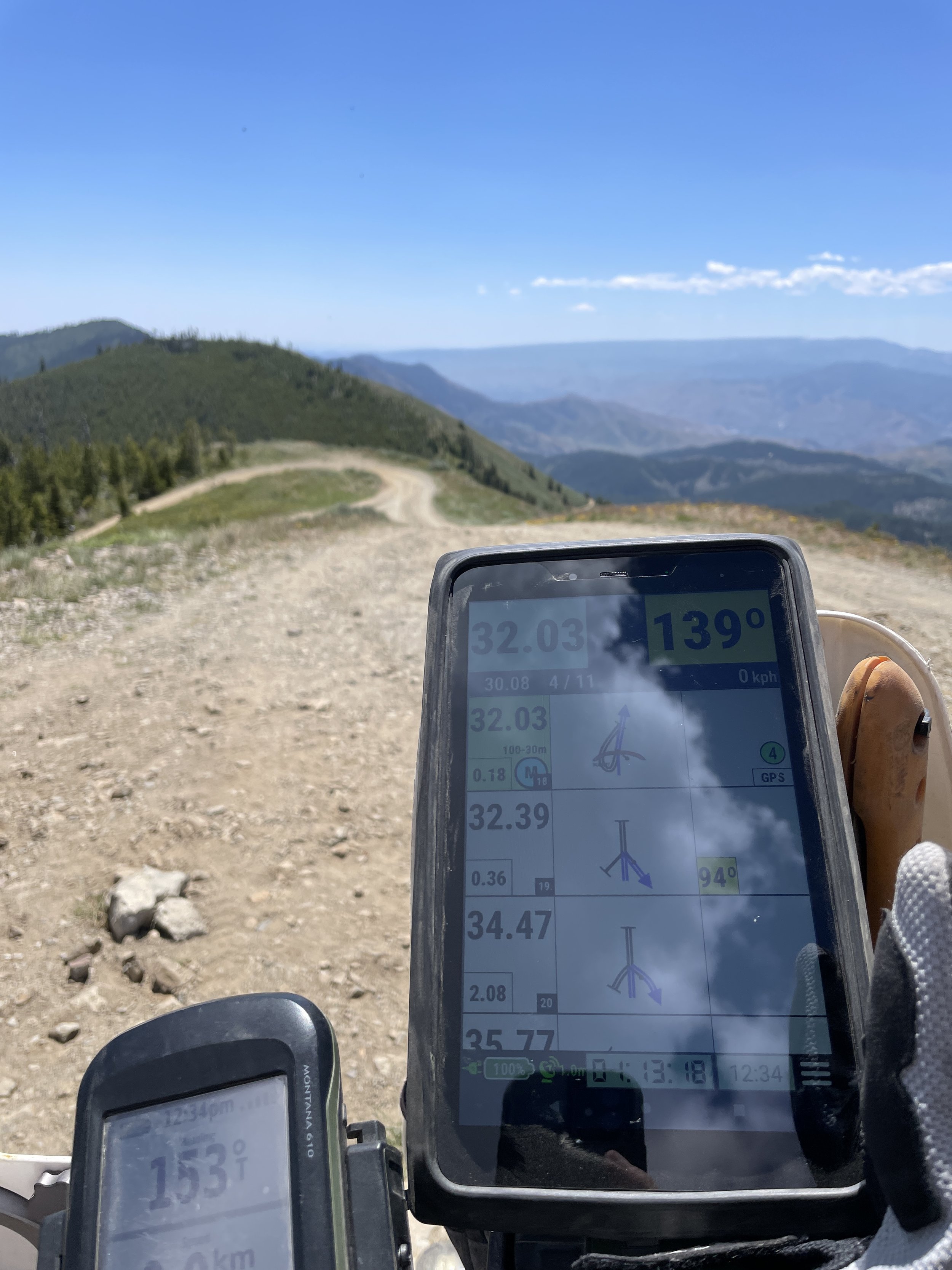
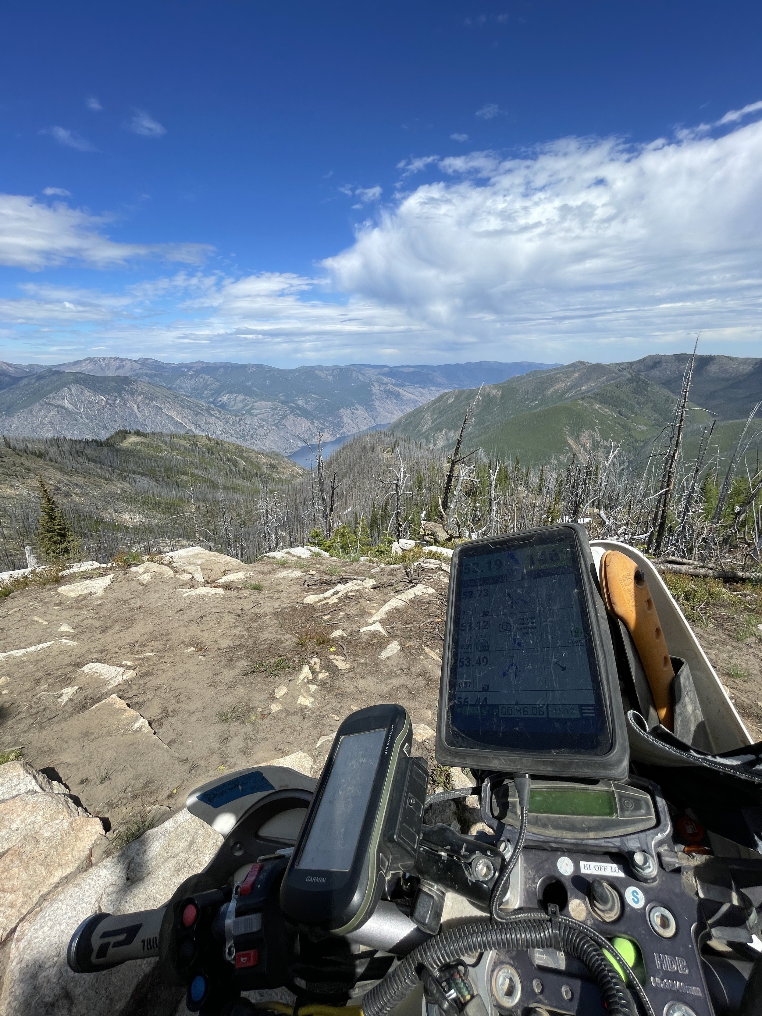
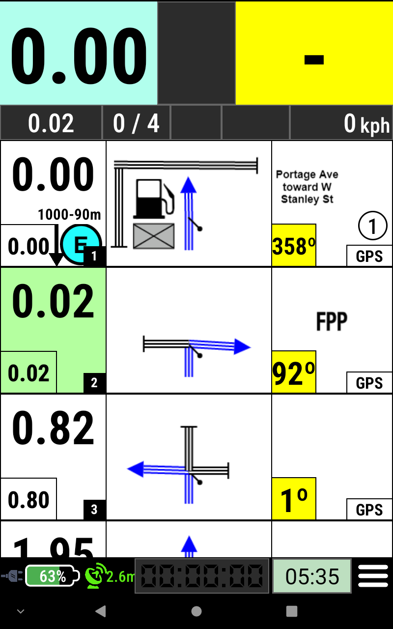
The collection includes 7 great Roadbook Tours. The roads and trails in the Gifford Pinchot National Forest are some of the most scenic and fun routes in Washington. You will find yourself stopping to take pictures many times along these Roadbook Tours. The routes offer a great mix and variety of terrain, road types, elevations, views and even temperatures. You will be riding from the valleys up and over the passes with views of the surrounding mountains and valleys including Mt. Adams, Mt. St. Helens, Mt. Rainier and Mt. Hood. The roadbook tours include helpful information to help you stay on the route including WPMs and GPS for many of the notes. You will be able to use these tools to get yourself back on track if you get lost. Notes with WPM and GPS are spread along the route every 15-20 km. All fuel stops are WPMs and have GPS available. Many of the snow-parks, trailheads and campgrounds along the route have GPS. Not only do the WPMs give you extra confidence in your location, they also keep your tripmeter adjusted for you since they set your tripmeter correctly whenever you validate one. Be sure to review WPM and GPS functionality in the NWRB Blog Posts before you head out.
Most of the road types in the routes are Pavement, Gravel and/or 2 Track. The Adventure Roadbook Tours are mostly tarmac, graded gravel, and 2 track. The Dual Sport Roadbook Tours step it up adding rutted 2 track, more rocks, more challenging grades and single track. The single track is very narrow and overgrown. Please do not attempt to ride the Dual Sport Roadbook Tours with single track in them on a large adventure bike. Definitely no panniers and no boxers on the singletrack.
The Roadbook Tours all start and finish at the Randle 76 Station where there is fuel available. You can pay-at-the-pump for gasoline 24-7. The store is generally open during the day. Camping is available nearby at public and private campgrounds (including the Celtic Elk CG) and many dispersed camp sites.
This is NOT a race! No hazards are marked.
Includes the following Roadbook Tours:
NWRB GPNF-N1 Randle Newbie Adventure Loop
Start (DZ) and Finish (FZ) at Randle 76 Station
Overall distance: 56 km
Fuel range required: 56 km
Highest Elevation: 350 m
Road/terrain types in roadbook: Pavement, Graded gravel
General description:
If you have never done a roadbook before or are feeling a little rusty, start with this one. It is a basic, short loop with easy navigation and comfortable roads to get you started. The roadbook has a WPE (Waypoint Eclipsed) at the first note, DSS (Depart Special Stage), WPMs (Waypoint Masked) and an ASS (Arrival Special Stage) just like the longer Roadbook Tours do. Every note has GPS available so it will be easy to get yourself back on track when you get lost.
Consult the Blog Posts at www.NWRoadbooks.com for help with basic navigation and understanding waypoints.
Remember, you can always run it again to make sure you understand the basics before trying one of the more advanced Roadbook Tours.
You will be riding thru curvy mountain roads. There will be oncoming traffic. Be careful.
Try to concentrate on making a clean run, not going fast.
This is NOT a race! No hazards are marked.
GPNF-N2 Blast Zone Adventure Loop
Start (DZ) and Finish (FZ) at Randle 76 Station
Overall distance: 154 km
Fuel range required: 154 km
Highest Elevation: 1300 m
Road/terrain types in roadbook: Pavement, Graded gravel
General description:
Be sure to fill up with gas in Randle. There will not be a gas stop along this loop. You will head south up into the foothills as you begin to make your climb up. Once you cross the Cispus River, the road will change to graded gravel. You will climb as you follow along the sidehill. The road will turn to tarmac as you approach the spur road to Windy Ridge. Much of this route is fun bumpy lumpy curvy paved forest roads. Watch for oncoming traffic that can appear out of nowhere around a corner. As you get closer to the mountain, you will ride around a corner and suddenly all the trees are wiped out laying in the same direction. You will wonder how long has it been?? There are many pullouts along the route. One of our favorites is to have a look at Miners Car. Stop and take in the views. The forest is finally reclaiming the ground that had nothing growing on it for so long. At Windy Ridge, you can look right into Mt. St. Helens. For an even better view, climb up all those stairs. It is worth it. Down below you can see the trees still floating around in Spirit Lake. And of course, the mountain. At least what is left of it. After you are done pondering the vast destruction, jump back on your bike and head back the way you came. Be sure to reset your tripmeter near the sign on your way out. Headed back, there are more viewpoints and pullouts to explore. Try to spot Mt. Adams, Mt. Hood and Mt. Rainier. Some are easy to see but some are only visible in just the right location. Once you leave the blast zone, the forest will close back in around you. Enjoy the trip back down on more of those twisty curvy bumpy paved roads.
Consult the Blog Posts at www.NWRoadbooks.com for help with basic navigation and understanding waypoints.
You will be riding thru curvy mountain roads. There will be oncoming traffic. Be careful.
Try to concentrate on making a clean run, not going fast.
This is NOT a race! No hazards are marked.
GPNF-N3 Lakes Adventure Loop
Start (DZ) and Finish (FZ) at Randle 76 Station
Overall distance: 196 km
Fuel range required: 165 km
Highest Elevation: 1600 m
Road/terrain types in roadbook: Pavement, Graded gravel, 2 Track
General description:
This route has smooth pavement, bumpy FS pavement, wide graded gravel roads and a sprinkling of 2 track roads. You will find yourself taking backroads following the river parallel to the highway. After a quick jaunt into Packwood to top off your gas tank, you will hit the gravel and make your way up into the forest. You will take a spur on some smaller 2 track and then back onto a larger gravel road. It will turn into tarmac before you turn off onto another paved FS road headed back up higher. As you gain elevation, the road will switch back to gravel. The route takes you past several of the High Mountain Lakes. Pay attention to the signs if you want to go for a swim. A great spot to stop for a break is at Takhlakh Lake where you can see a beautiful reflection of Mt. Adams in its calm waters. Enter the campground and then take a left at the day use / boat launch area. If you want to take a longer break, there is a nice hiking trail that goes around the lake. Next you will make your way back north on gravel passing more of the high lakes, campgrounds, horse camps and trail heads. Then you will traverse your way west along a great stretch of gravel FS road before making one last very curvy descent down to the pavement and finally back to the starting point at the Randle station.
Consult the Blog Posts at www.NWRoadbooks.com for help with basic navigation and understanding waypoints.
You will be riding thru curvy mountain roads. There will be oncoming traffic. Be careful.
Try to concentrate on making a clean run, not going fast.
This is NOT a race! No hazards are marked.
NWRB GPNF-N4 Big One Adventure Loop
Start (DZ) and Finish (FZ) at Randle 76 Station
Overall distance: 486 km
Fuel range required: 118 km
Highest Elevation: 1450 m
Road/terrain types in roadbook: Pavement, Graded gravel
General description:
Start with a full tank and don’t pass a gas station. Fuel stops are far apart in this area. This loop will take you from one side of the forest to the other over some of the highest passes around. On your way, you will get up close to 3 volcanos. You will start out traveling south over scenic FS roads before stopping into the seasonal Eagle Cliff General Store. Call ahead to check their hours if you plan to fill up there. Enjoy the scenic viewpoint among the twisties in the paved climb. Next you will get off the main track and enjoy some views of the south side of Mt. St. Helens. The route will take you to Carson, where you will find a 24-7 pay-at-the pump fuel station. Leaving Carson, you will cross the forest over a fun curvy hill before dropping into Trout Lake. The fuel station at Trout Lake is only open during the day. Be sure to contact them if you plan to fuel up there. We hear there is some tasty food at the café next door. Let us know how it is. The route then takes you back up north on several great FS roads getting closer to the base of Mt. Adams along the way. Be sure to stop at the Takhlakh Lake Campground boat launch for a perfect postcard view of Mt. Adams reflected in the lake. Next the route drops down to the highway before hitting Packwood for a gas stop. Both fuel stations in Packwood have 24-7 pay-at-the-pump gas available. The final leg takes you up into the scenic hills north of Highway 12. This is your chance to get closer to Mount Rainier. Enjoy more epic views from the lookout. You will have one last pass to climb over before finally dropping back down to your starting point in Randle.
Wow! What a loop!
Consult the Blog Posts at www.NWRoadbooks.com for help with basic navigation and understanding waypoints.
You will be riding thru curvy mountain roads. There will be oncoming traffic. Be careful.
Try to concentrate on making a clean run, not going fast.
This is NOT a race! No hazards are marked.
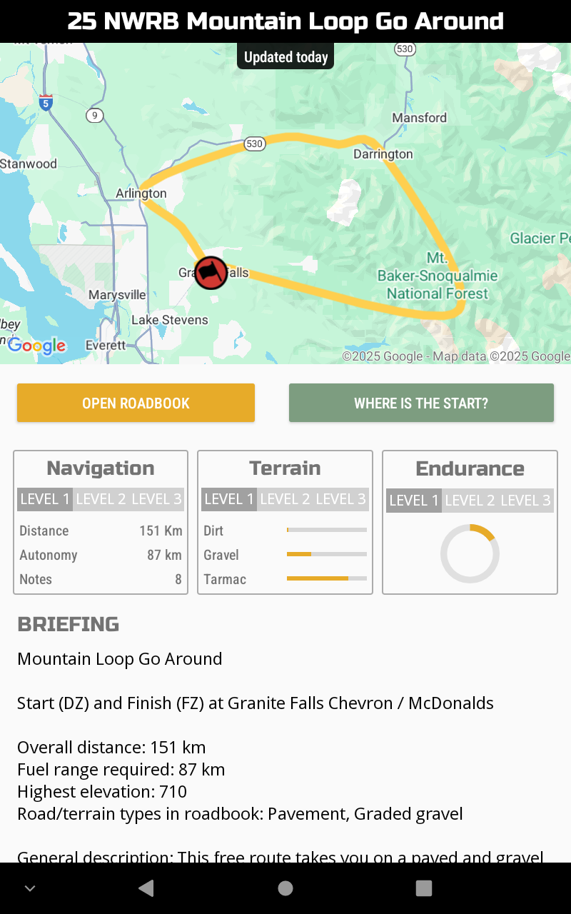
GPNF-N5 Golden Ticket Dual Sport Loop
Start (DZ) and Finish (FZ) at Randle 76 Station
Overall distance: 151 km
Fuel range required: 151 km
Highest Elevation: 1500 m
Road/terrain types in roadbook: Pavement, Graded gravel, 2 Track, Single Track
General description:
Be sure to fill up with gas in Randle. This route has smooth pavement, bumpy FS pavement, wide graded gravel roads, 2 track and even some former roads that have degraded down to single track. You will find yourself travelling parallel to the river on gravel. This nice gravel road has some surprises in store for you with a bit of trail at the start and then a big pile of rocks to make your way over. After many crossings, you will return back to pavement for a short while. Then you will climb a rocky, rutted 2 track / single track road and then suddenly hit some more pavement. The pavement will be short lived, and you will be back on the gravel. Be sure to stop at Takhlakh Lake and visit the day use area / launch ramp for a stunning view of Mt. Adams with the reflective lake in the foreground. The route will take you closer to Mt. Adams and then back north along a well-traveled Adventure Route before breaking off. The last section of gravel is a great one as you climb up. You will have some views of the valley below and if you are lucky, you may spot Mt. Rainier and the highway down in the valley below you. After a very curvy long downhill, you will drop back on pavement and finish your ride back at the start point.
Consult the Blog Posts at www.NWRoadbooks.com for help with basic navigation and understanding waypoints.
You will be riding thru curvy mountain roads. There will be oncoming traffic. Be careful.
Try to concentrate on making a clean run, not going fast.
This is NOT a race! No hazards are marked.
NWRB GPNF-N6 Savage North Half Dual Sport Loop
Start (DZ) and Finish (FZ) at Randle 76 Station
Overall distance: 196 km
Fuel range required: 196 km
Highest Elevation: 1450 m
Road/terrain types in roadbook: Pavement, Graded gravel, 2 Track, Rutted 2 Track, Singletrack
General description:
We took our big Savage Full Dual Sport loop and cut it in half for you to enjoy a shorter portion. The loop begins in Randle and heads up into the foothills. It won’t be long before you find yourself on a fun flowing section of single track. Once you are all warmed up, you will make your way back onto more fun paved FS roads. After a fantastic gravel climb, enjoy the beautiful view at one of the lookouts in the area. More great gravel and 2 track as you head south. You will get onto pavement before pulling off onto a rough gravel road that begins your return. More lumpy bumpy pavement before hitting another single track section. Once you complete the section, you will continue on some more paved FS roads. Up you go again on gravel to another viewpoint. This downhill single track section is your final test and the start of your descent back down to your starting point. Of course, there are plenty of great gravel and paved roads left to get you back.
This route contains single track sections. Some of them are very narrow and are not recommended for larger adventure bikes or bikes with pannier boxes on the sides. The obstacles along the sides of the trail are often hidden in brush and could cause a larger bike to crash and/or get thrown off the trail. On these trails, that could be a very big problem. Please do not attempt this Roadbook Tour on wide bikes with a boxer engine or on bikes with panniers or large luggage on them.
Consult the Blog Posts at www.NWRoadbooks.com for help with basic navigation and understanding waypoints.
You will be riding thru curvy mountain roads. There will be oncoming traffic. Be careful.
Try to concentrate on making a clean run, not going fast.
This is NOT a race! No hazards are marked.
NWRB GPNF-N7 Savage Full Dual Sport Loop
Start (DZ) and Finish (FZ) at Randle 76 Station
Overall distance: 411 km
Fuel range required: 242 km
Highest Elevation: 1450 m
Road/terrain types in roadbook: Pavement, Graded gravel, 2 Track, Rutted 2 Track, Single Track Trail
General description:
This one is Savage. At least in its length. Start early. Be sure to fill up with gas in Randle. It is a long way before you get to gas! Much of this route is fun bumpy lumpy curvy paved forest roads. Watch for oncoming traffic that can appear out of nowhere around a corner. You will also encounter graded gravel, 2 track roads, rutted 2 track roads and some of the easier single-track trails in the area along this route. All the trails are passable by a rider of average skill on a Dual Sport Motorcycle. If you are planning to take this route on with a larger Adventure bike, gather your group up and tackle the single-track sections together. Do not attempt with panniers and/or a bike with a boxer engine.
The loop begins in Randle and heads up into the foothills. It won’t be long before you find yourself on a fun flowing section of single track. Once you are all warmed up, you will make your way back onto more fun paved FS roads. After a fantastic gravel climb, enjoy the beautiful view at one of the lookouts in the area. More great gravel and 2 track as you head south before looping around Indian Heaven Wilderness. Eventually you will find yourself on the outskirts of Carson at a gas station. Fill your tank to the top before heading back north. This isn’t just a pit stop for your bike. Take care of your needs too by getting something in your fuel tank too. Maybe a snack and drink for the road too?
On your ride northbound, you will find the paved road getting smaller and smaller as you get into the forest. Stop at Panther Creek Falls to see the sight. More of those bumpy curvy paved FS roads are there for you to enjoy as you make your way north. Eventually they turn into gravel and then suddenly a note tells you to drop onto some more singletrack. Once you complete the section, you will continue on some more paved FS roads. Up you go again on gravel to another viewpoint. The road will degrade with ruts that get bigger and bigger before it shrinks down to single track. This downhill single track section is your final test and the start of your descent back down to your starting point. Of course, there are plenty of great gravel and paved roads left to get you back.
This route contains single track sections. Some of them are very narrow and are not recommended for larger adventure bikes or bikes with pannier boxes on the sides. The obstacles along the sides of the trail are often hidden in brush and could cause a larger bike to crash and/or get thrown off the trail. On these trails, that could be a very big problem. Please do not attempt this Roadbook Tour on wide bikes with a boxer engine or on bikes with panniers or large luggage on them.
Consult the Blog Posts at www.NWRoadbooks.com for help with basic navigation and understanding waypoints.
You will be riding thru curvy mountain roads. There will be oncoming traffic. Be careful.
Try to concentrate on making a clean run, not going fast.
This is NOT a race! No hazards are marked.
NWRB GPNF-North Roadbook Tour Collection
Start (DZ) and Finish (FZ) at Randle 76 Station
Total distance: 1650 km
Road/terrain types in roadbook: Pavement, Graded gravel, 2 Track, Overgrown 2 Track, Rough 2 Track, Single Track
General description:
The collection includes 7 great Roadbook Tours. The roads and trails in the Gifford Pinchot National Forest are some of the most scenic and fun routes in Washington. You will find yourself stopping to take pictures many times along these Roadbook Tours. The routes offer a great mix and variety of terrain, road types, elevations, views and even temperatures. You will be riding from the valleys up and over the passes with views of the surrounding mountains and valleys including Mt. Adams, Mt. St. Helens, Mt. Rainier and Mt. Hood. The roadbook tours include helpful information to help you stay on the route including WPMs and GPS for many of the notes. You will be able to use these tools to get yourself back on track if you get lost. Notes with WPM and GPS are spread along the route every 15-20 km. All fuel stops are WPMs and have GPS available. Many of the snow-parks, trailheads and campgrounds along the route have GPS. Not only do the WPMs give you extra confidence in your location, they also keep your tripmeter adjusted for you since they set your tripmeter correctly whenever you validate one. Be sure to review WPM and GPS functionality in the NWRB Blog Posts before you head out.
Most of the road types in the routes are Pavement, Gravel and/or 2 Track. The Adventure Roadbook Tours are mostly tarmac, graded gravel, and 2 track. The Dual Sport Roadbook Tours step it up adding rutted 2 track, more rocks, more challenging grades and single track. The single track is very narrow and overgrown. Please do not attempt to ride the Dual Sport Roadbook Tours with single track in them on a large adventure bike. Definitely no panniers and no boxers on the singletrack.
The Roadbook Tours all start and finish at the Randle 76 Station where there is fuel available. You can pay-at-the-pump for gasoline 24-7. The store is generally open during the day. Camping is available nearby at public and private campgrounds (including the Celtic Elk CG) and many dispersed camp sites.
This is NOT a race! No hazards are marked.
Includes the following Roadbook Tours:
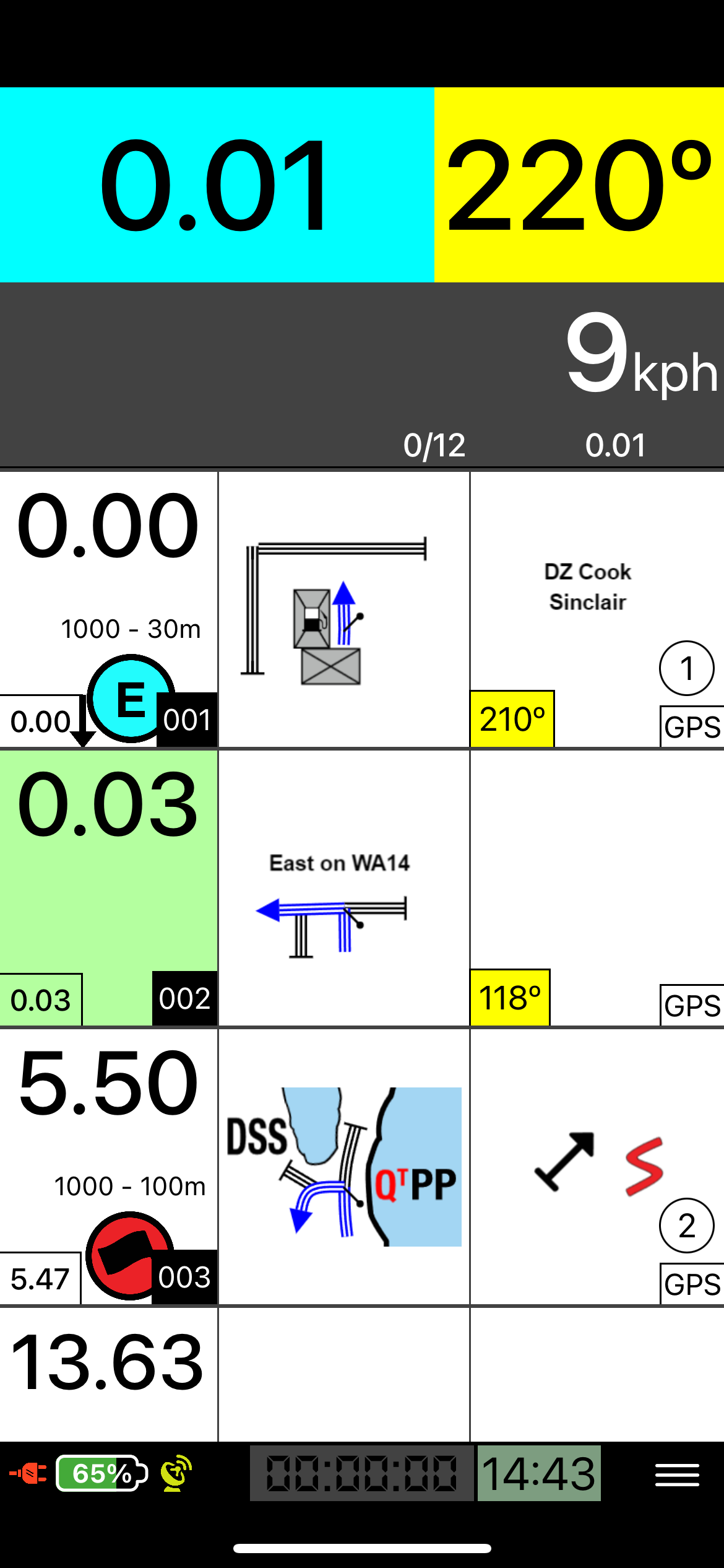
NWRB GPNF-N1 Randle Newbie Adventure Loop
Start (DZ) and Finish (FZ) at Randle 76 Station
Overall distance: 56 km
Fuel range required: 56 km
Highest Elevation: 350 m
Road/terrain types in roadbook: Pavement, Graded gravel
General description:
If you have never done a roadbook before or are feeling a little rusty, start with this one. It is a basic, short loop with easy navigation and comfortable roads to get you started. The roadbook has a WPE (Waypoint Eclipsed) at the first note, DSS (Depart Special Stage), WPMs (Waypoint Masked) and an ASS (Arrival Special Stage) just like the longer Roadbook Tours do. Every note has GPS available so it will be easy to get yourself back on track when you get lost.
Consult the Blog Posts at www.NWRoadbooks.com for help with basic navigation and understanding waypoints.
Remember, you can always run it again to make sure you understand the basics before trying one of the more advanced Roadbook Tours.
You will be riding thru curvy mountain roads. There will be oncoming traffic. Be careful.
Try to concentrate on making a clean run, not going fast.
This is NOT a race! No hazards are marked.
GPNF-N2 Blast Zone Adventure Loop
Start (DZ) and Finish (FZ) at Randle 76 Station
Overall distance: 154 km
Fuel range required: 154 km
Highest Elevation: 1300 m
Road/terrain types in roadbook: Pavement, Graded gravel
General description:
Be sure to fill up with gas in Randle. There will not be a gas stop along this loop. You will head south up into the foothills as you begin to make your climb up. Once you cross the Cispus River, the road will change to graded gravel. You will climb as you follow along the sidehill. The road will turn to tarmac as you approach the spur road to Windy Ridge. Much of this route is fun bumpy lumpy curvy paved forest roads. Watch for oncoming traffic that can appear out of nowhere around a corner. As you get closer to the mountain, you will ride around a corner and suddenly all the trees are wiped out laying in the same direction. You will wonder how long has it been?? There are many pullouts along the route. One of our favorites is to have a look at Miners Car. Stop and take in the views. The forest is finally reclaiming the ground that had nothing growing on it for so long. At Windy Ridge, you can look right into Mt. St. Helens. For an even better view, climb up all those stairs. It is worth it. Down below you can see the trees still floating around in Spirit Lake. And of course, the mountain. At least what is left of it. After you are done pondering the vast destruction, jump back on your bike and head back the way you came. Be sure to reset your tripmeter near the sign on your way out. Headed back, there are more viewpoints and pullouts to explore. Try to spot Mt. Adams, Mt. Hood and Mt. Rainier. Some are easy to see but some are only visible in just the right location. Once you leave the blast zone, the forest will close back in around you. Enjoy the trip back down on more of those twisty curvy bumpy paved roads.
Consult the Blog Posts at www.NWRoadbooks.com for help with basic navigation and understanding waypoints.
You will be riding thru curvy mountain roads. There will be oncoming traffic. Be careful.
Try to concentrate on making a clean run, not going fast.
This is NOT a race! No hazards are marked.
GPNF-N3 Lakes Adventure Loop
Start (DZ) and Finish (FZ) at Randle 76 Station
Overall distance: 196 km
Fuel range required: 165 km
Highest Elevation: 1600 m
Road/terrain types in roadbook: Pavement, Graded gravel, 2 Track
General description:
This route has smooth pavement, bumpy FS pavement, wide graded gravel roads and a sprinkling of 2 track roads. You will find yourself taking backroads following the river parallel to the highway. After a quick jaunt into Packwood to top off your gas tank, you will hit the gravel and make your way up into the forest. You will take a spur on some smaller 2 track and then back onto a larger gravel road. It will turn into tarmac before you turn off onto another paved FS road headed back up higher. As you gain elevation, the road will switch back to gravel. The route takes you past several of the High Mountain Lakes. Pay attention to the signs if you want to go for a swim. A great spot to stop for a break is at Takhlakh Lake where you can see a beautiful reflection of Mt. Adams in its calm waters. Enter the campground and then take a left at the day use / boat launch area. If you want to take a longer break, there is a nice hiking trail that goes around the lake. Next you will make your way back north on gravel passing more of the high lakes, campgrounds, horse camps and trail heads. Then you will traverse your way west along a great stretch of gravel FS road before making one last very curvy descent down to the pavement and finally back to the starting point at the Randle station.
Consult the Blog Posts at www.NWRoadbooks.com for help with basic navigation and understanding waypoints.
You will be riding thru curvy mountain roads. There will be oncoming traffic. Be careful.
Try to concentrate on making a clean run, not going fast.
This is NOT a race! No hazards are marked.
NWRB GPNF-N4 Big One Adventure Loop
Start (DZ) and Finish (FZ) at Randle 76 Station
Overall distance: 486 km
Fuel range required: 118 km
Highest Elevation: 1450 m
Road/terrain types in roadbook: Pavement, Graded gravel
General description:
Start with a full tank and don’t pass a gas station. Fuel stops are far apart in this area. This loop will take you from one side of the forest to the other over some of the highest passes around. On your way, you will get up close to 3 volcanos. You will start out traveling south over scenic FS roads before stopping into the seasonal Eagle Cliff General Store. Call ahead to check their hours if you plan to fill up there. Enjoy the scenic viewpoint among the twisties in the paved climb. Next you will get off the main track and enjoy some views of the south side of Mt. St. Helens. The route will take you to Carson, where you will find a 24-7 pay-at-the pump fuel station. Leaving Carson, you will cross the forest over a fun curvy hill before dropping into Trout Lake. The fuel station at Trout Lake is only open during the day. Be sure to contact them if you plan to fuel up there. We hear there is some tasty food at the café next door. Let us know how it is. The route then takes you back up north on several great FS roads getting closer to the base of Mt. Adams along the way. Be sure to stop at the Takhlakh Lake Campground boat launch for a perfect postcard view of Mt. Adams reflected in the lake. Next the route drops down to the highway before hitting Packwood for a gas stop. Both fuel stations in Packwood have 24-7 pay-at-the-pump gas available. The final leg takes you up into the scenic hills north of Highway 12. This is your chance to get closer to Mount Rainier. Enjoy more epic views from the lookout. You will have one last pass to climb over before finally dropping back down to your starting point in Randle.
Wow! What a loop!
Consult the Blog Posts at www.NWRoadbooks.com for help with basic navigation and understanding waypoints.
You will be riding thru curvy mountain roads. There will be oncoming traffic. Be careful.
Try to concentrate on making a clean run, not going fast.
This is NOT a race! No hazards are marked.
GPNF-N5 Golden Ticket Dual Sport Loop
Start (DZ) and Finish (FZ) at Randle 76 Station
Overall distance: 151 km
Fuel range required: 151 km
Highest Elevation: 1500 m
Road/terrain types in roadbook: Pavement, Graded gravel, 2 Track, Single Track
General description:
Be sure to fill up with gas in Randle. This route has smooth pavement, bumpy FS pavement, wide graded gravel roads, 2 track and even some former roads that have degraded down to single track. You will find yourself travelling parallel to the river on gravel. This nice gravel road has some surprises in store for you with a bit of trail at the start and then a big pile of rocks to make your way over. After many crossings, you will return back to pavement for a short while. Then you will climb a rocky, rutted 2 track / single track road and then suddenly hit some more pavement. The pavement will be short lived, and you will be back on the gravel. Be sure to stop at Takhlakh Lake and visit the day use area / launch ramp for a stunning view of Mt. Adams with the reflective lake in the foreground. The route will take you closer to Mt. Adams and then back north along a well-traveled Adventure Route before breaking off. The last section of gravel is a great one as you climb up. You will have some views of the valley below and if you are lucky, you may spot Mt. Rainier and the highway down in the valley below you. After a very curvy long downhill, you will drop back on pavement and finish your ride back at the start point.
Consult the Blog Posts at www.NWRoadbooks.com for help with basic navigation and understanding waypoints.
You will be riding thru curvy mountain roads. There will be oncoming traffic. Be careful.
Try to concentrate on making a clean run, not going fast.
This is NOT a race! No hazards are marked.
NWRB GPNF-N6 Savage North Half Dual Sport Loop
Start (DZ) and Finish (FZ) at Randle 76 Station
Overall distance: 196 km
Fuel range required: 196 km
Highest Elevation: 1450 m
Road/terrain types in roadbook: Pavement, Graded gravel, 2 Track, Rutted 2 Track, Singletrack
General description:
We took our big Savage Full Dual Sport loop and cut it in half for you to enjoy a shorter portion. The loop begins in Randle and heads up into the foothills. It won’t be long before you find yourself on a fun flowing section of single track. Once you are all warmed up, you will make your way back onto more fun paved FS roads. After a fantastic gravel climb, enjoy the beautiful view at one of the lookouts in the area. More great gravel and 2 track as you head south. You will get onto pavement before pulling off onto a rough gravel road that begins your return. More lumpy bumpy pavement before hitting another single track section. Once you complete the section, you will continue on some more paved FS roads. Up you go again on gravel to another viewpoint. This downhill single track section is your final test and the start of your descent back down to your starting point. Of course, there are plenty of great gravel and paved roads left to get you back.
This route contains single track sections. Some of them are very narrow and are not recommended for larger adventure bikes or bikes with pannier boxes on the sides. The obstacles along the sides of the trail are often hidden in brush and could cause a larger bike to crash and/or get thrown off the trail. On these trails, that could be a very big problem. Please do not attempt this Roadbook Tour on wide bikes with a boxer engine or on bikes with panniers or large luggage on them.
Consult the Blog Posts at www.NWRoadbooks.com for help with basic navigation and understanding waypoints.
You will be riding thru curvy mountain roads. There will be oncoming traffic. Be careful.
Try to concentrate on making a clean run, not going fast.
This is NOT a race! No hazards are marked.
NWRB GPNF-N7 Savage Full Dual Sport Loop
Start (DZ) and Finish (FZ) at Randle 76 Station
Overall distance: 411 km
Fuel range required: 242 km
Highest Elevation: 1450 m
Road/terrain types in roadbook: Pavement, Graded gravel, 2 Track, Rutted 2 Track, Single Track Trail
General description:
This one is Savage. At least in its length. Start early. Be sure to fill up with gas in Randle. It is a long way before you get to gas! Much of this route is fun bumpy lumpy curvy paved forest roads. Watch for oncoming traffic that can appear out of nowhere around a corner. You will also encounter graded gravel, 2 track roads, rutted 2 track roads and some of the easier single-track trails in the area along this route. All the trails are passable by a rider of average skill on a Dual Sport Motorcycle. If you are planning to take this route on with a larger Adventure bike, gather your group up and tackle the single-track sections together. Do not attempt with panniers and/or a bike with a boxer engine.
The loop begins in Randle and heads up into the foothills. It won’t be long before you find yourself on a fun flowing section of single track. Once you are all warmed up, you will make your way back onto more fun paved FS roads. After a fantastic gravel climb, enjoy the beautiful view at one of the lookouts in the area. More great gravel and 2 track as you head south before looping around Indian Heaven Wilderness. Eventually you will find yourself on the outskirts of Carson at a gas station. Fill your tank to the top before heading back north. This isn’t just a pit stop for your bike. Take care of your needs too by getting something in your fuel tank too. Maybe a snack and drink for the road too?
On your ride northbound, you will find the paved road getting smaller and smaller as you get into the forest. Stop at Panther Creek Falls to see the sight. More of those bumpy curvy paved FS roads are there for you to enjoy as you make your way north. Eventually they turn into gravel and then suddenly a note tells you to drop onto some more singletrack. Once you complete the section, you will continue on some more paved FS roads. Up you go again on gravel to another viewpoint. The road will degrade with ruts that get bigger and bigger before it shrinks down to single track. This downhill single track section is your final test and the start of your descent back down to your starting point. Of course, there are plenty of great gravel and paved roads left to get you back.
This route contains single track sections. Some of them are very narrow and are not recommended for larger adventure bikes or bikes with pannier boxes on the sides. The obstacles along the sides of the trail are often hidden in brush and could cause a larger bike to crash and/or get thrown off the trail. On these trails, that could be a very big problem. Please do not attempt this Roadbook Tour on wide bikes with a boxer engine or on bikes with panniers or large luggage on them.
Consult the Blog Posts at www.NWRoadbooks.com for help with basic navigation and understanding waypoints.
You will be riding thru curvy mountain roads. There will be oncoming traffic. Be careful.
Try to concentrate on making a clean run, not going fast.
This is NOT a race! No hazards are marked.
 Image 1 of 31
 Image 2 of 31
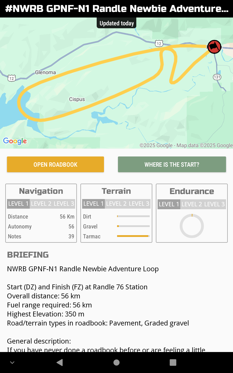 Image 3 of 31
 Image 4 of 31
 Image 5 of 31
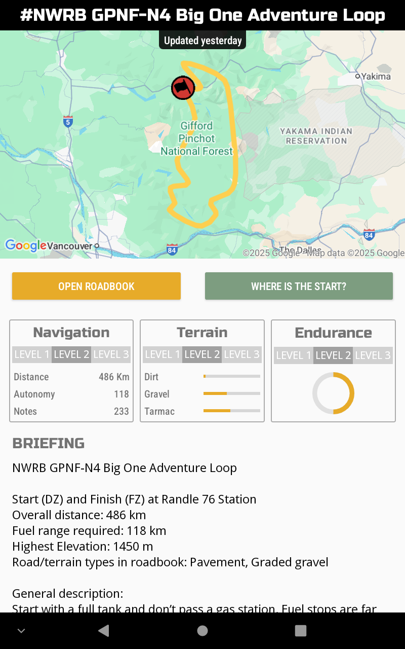 Image 6 of 31
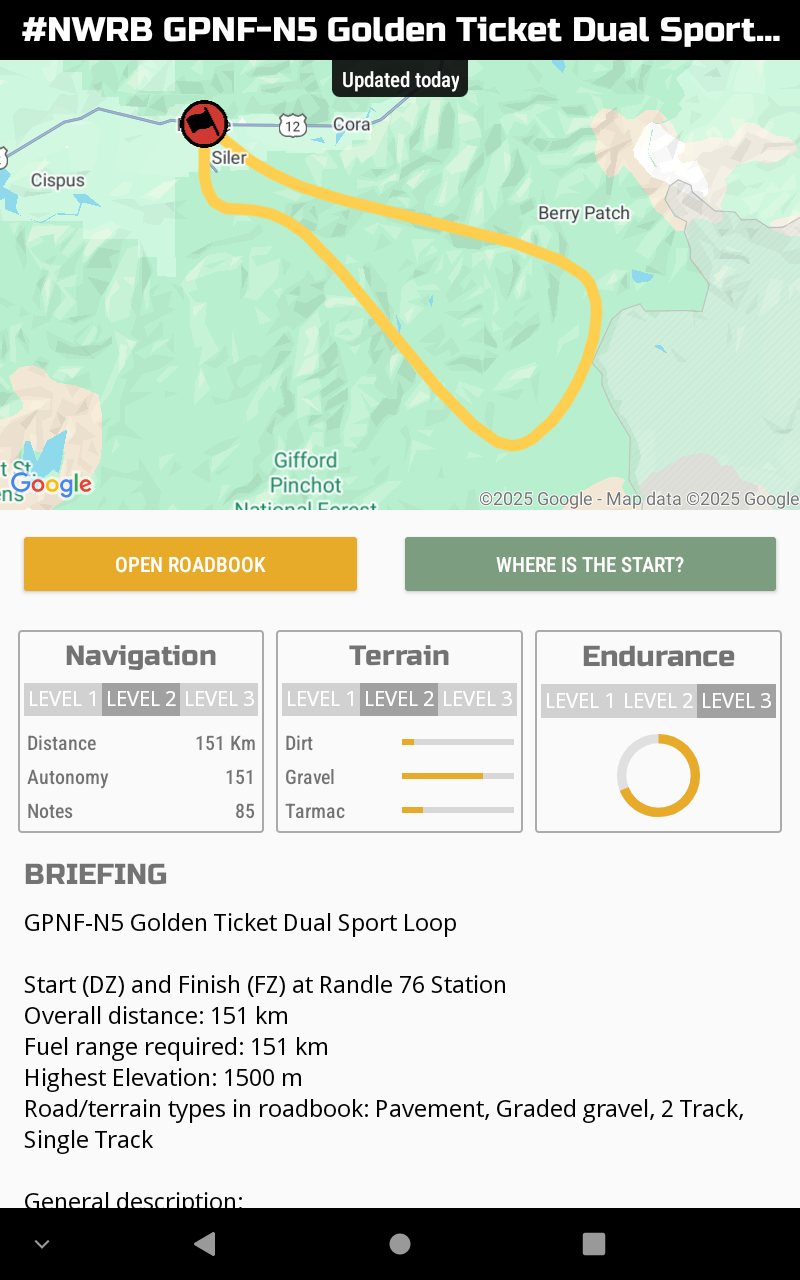 Image 7 of 31
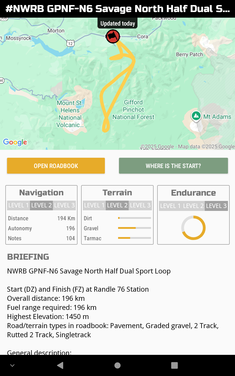 Image 8 of 31
 Image 9 of 31
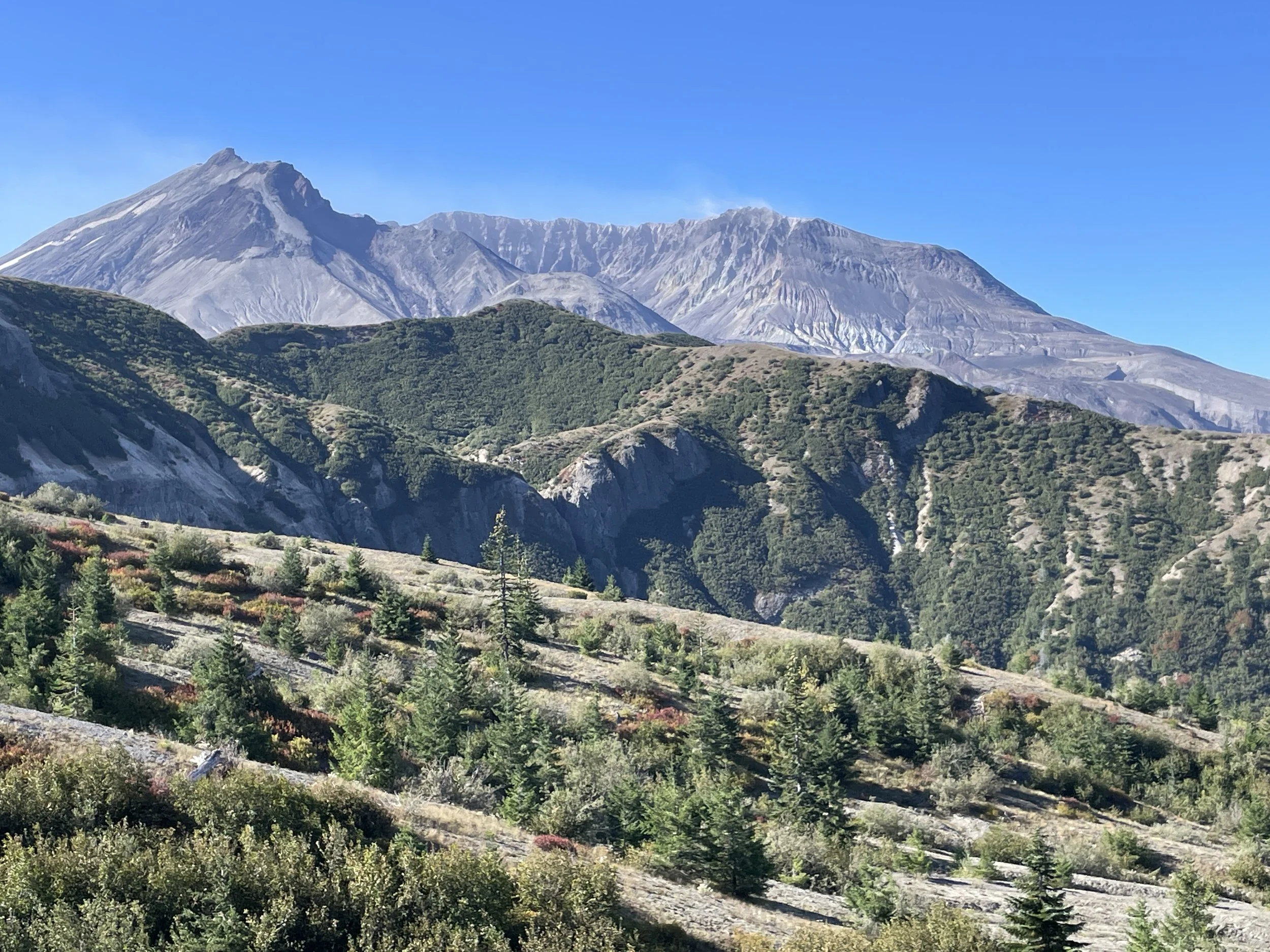 Image 10 of 31
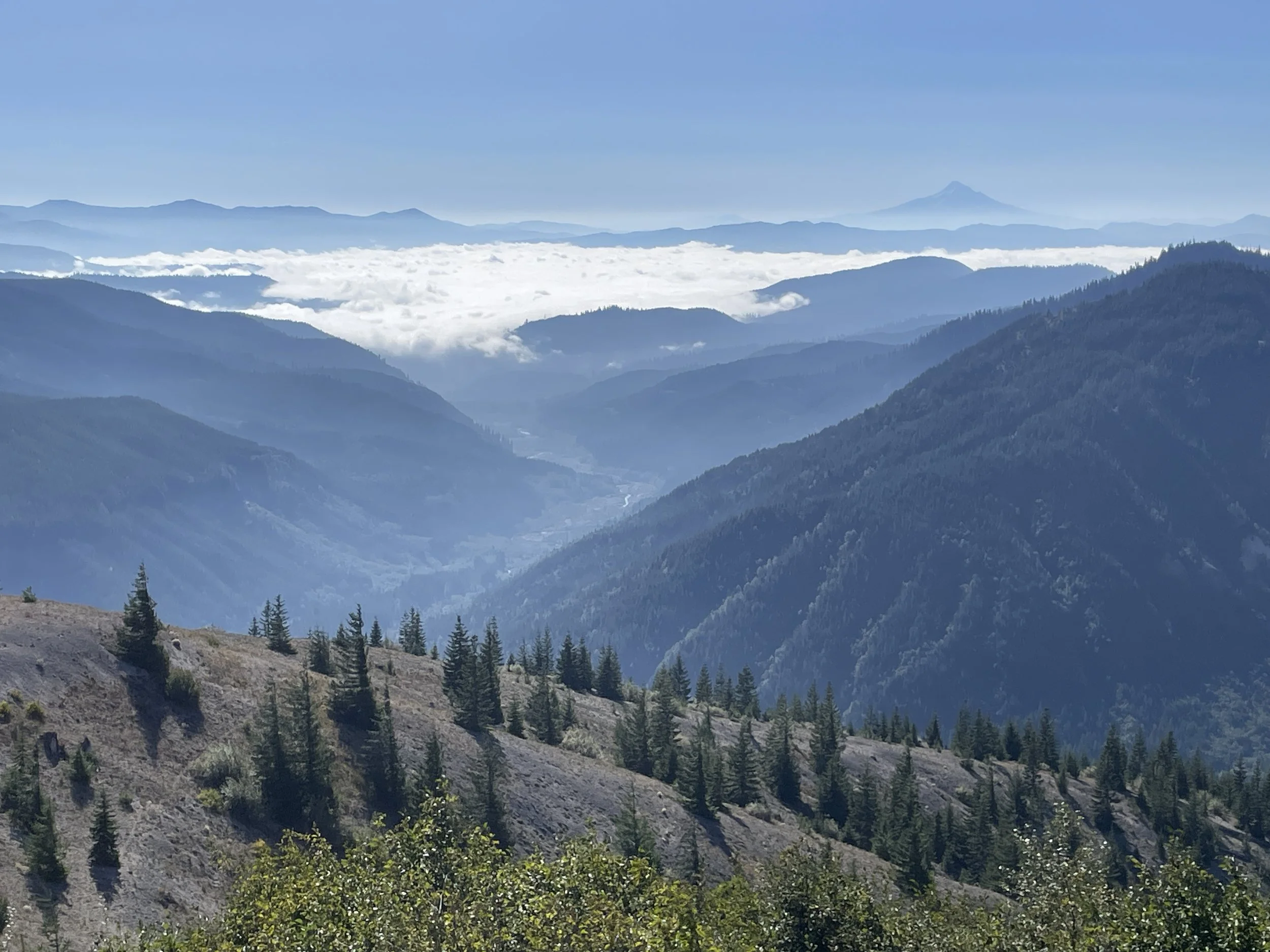 Image 11 of 31
 Image 12 of 31
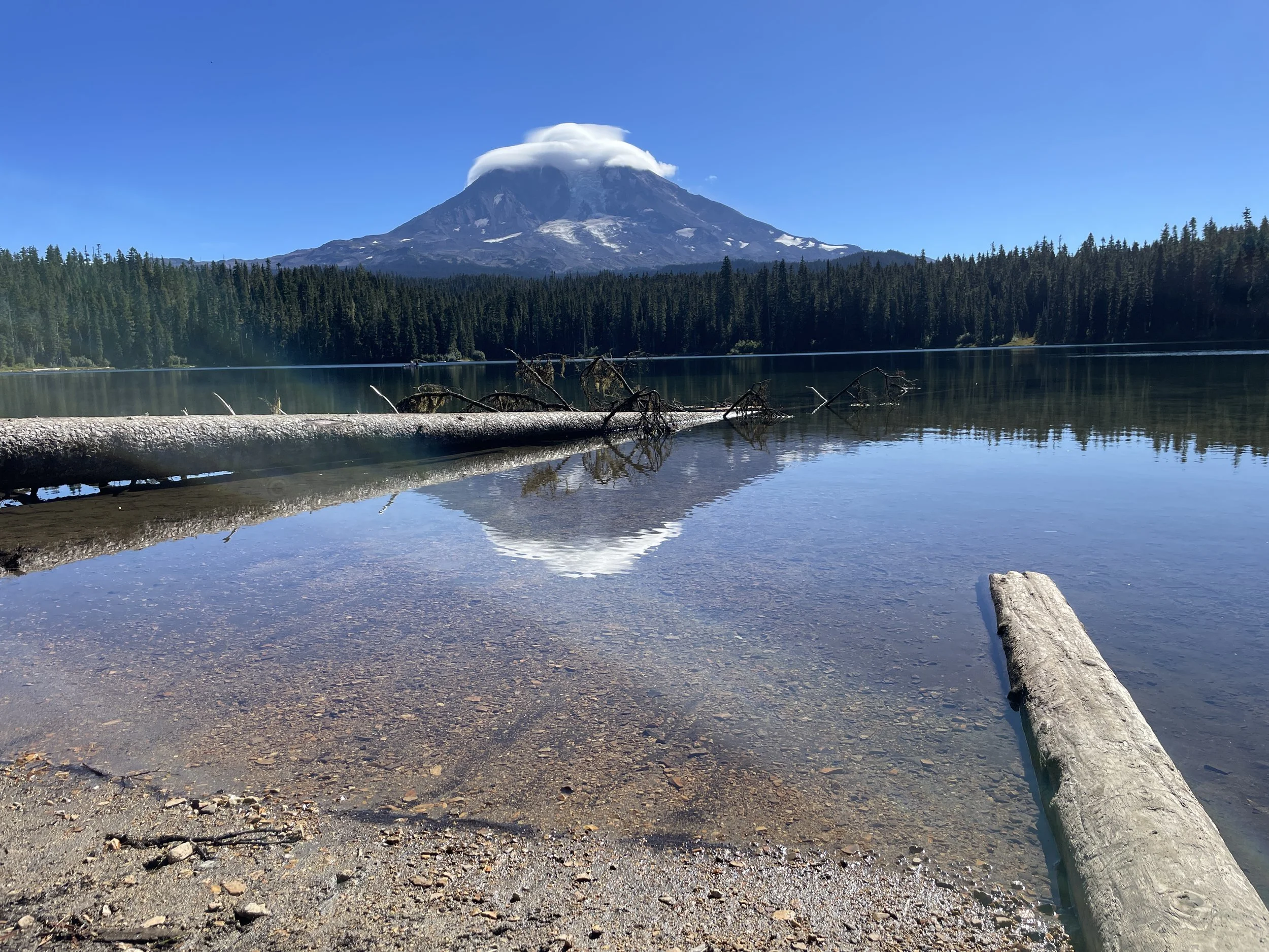 Image 13 of 31
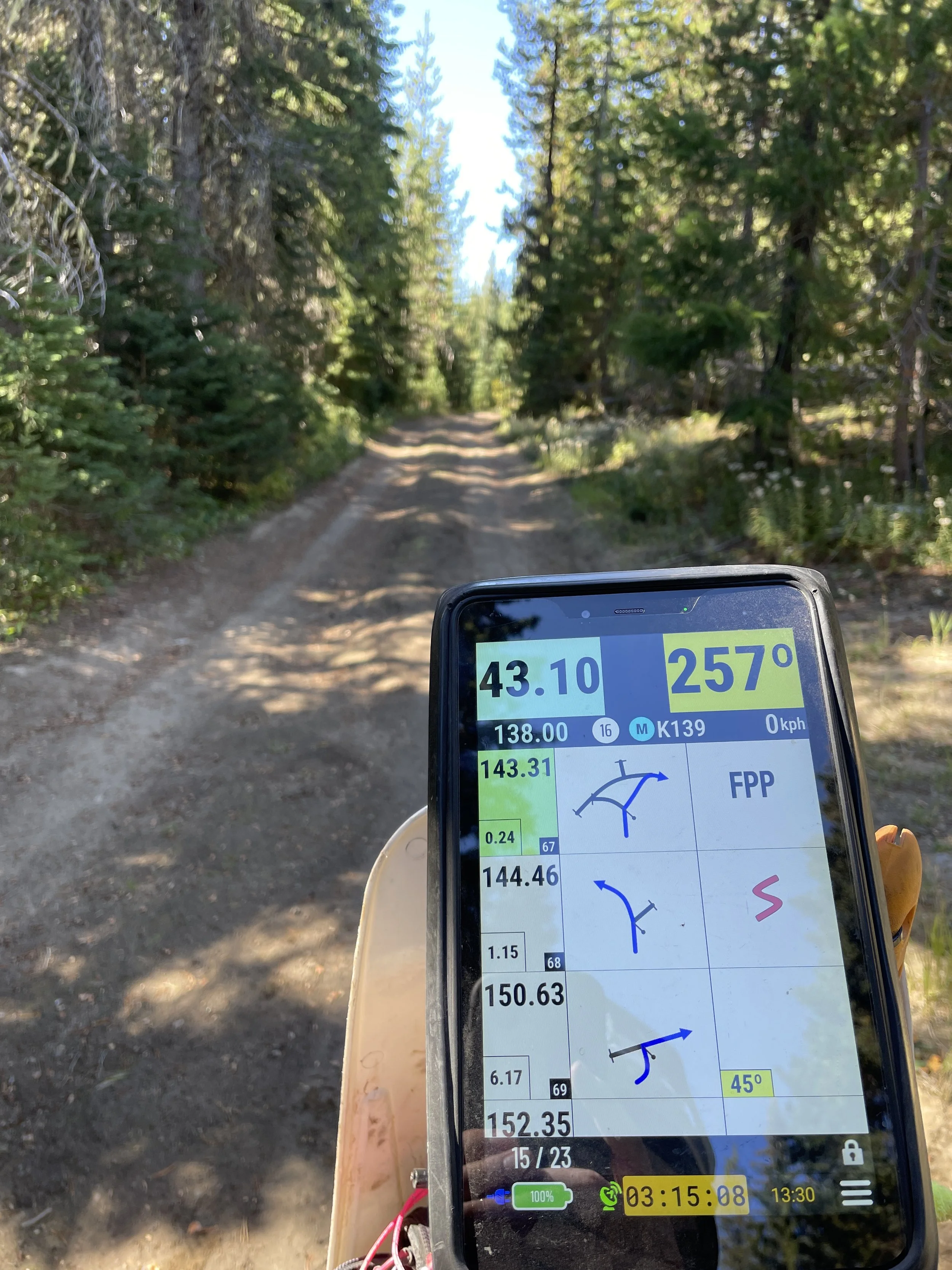 Image 14 of 31
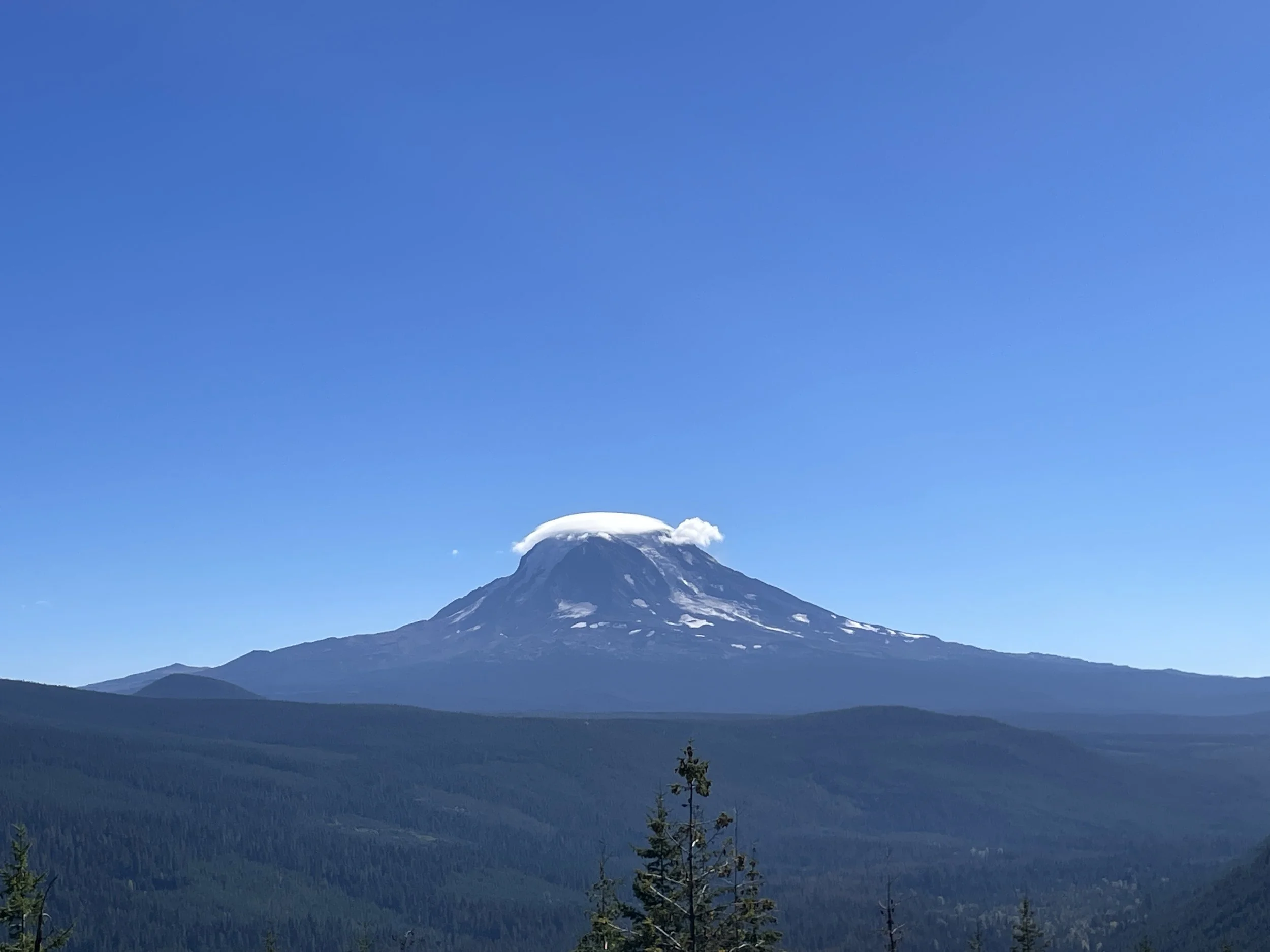 Image 15 of 31
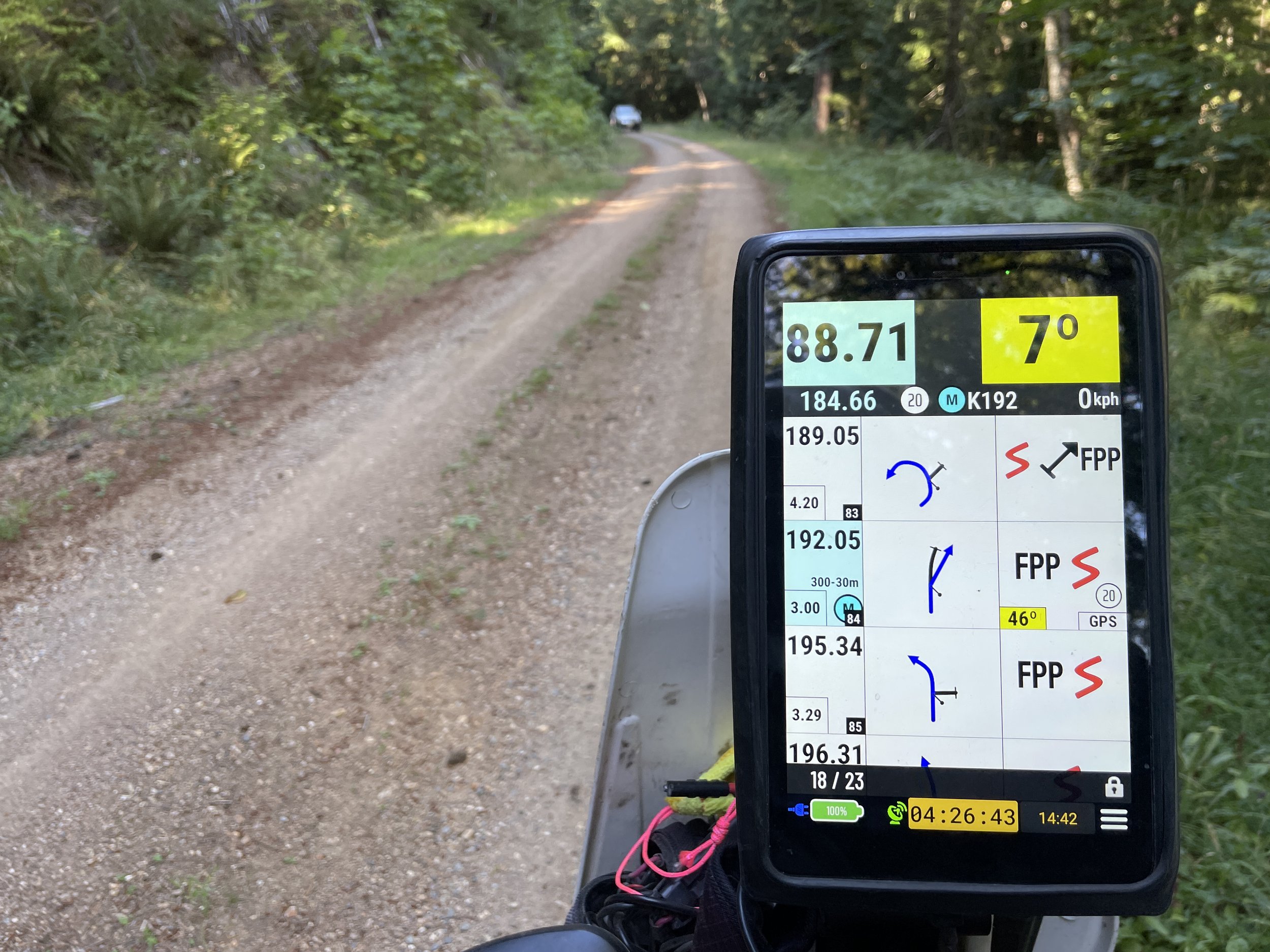 Image 16 of 31
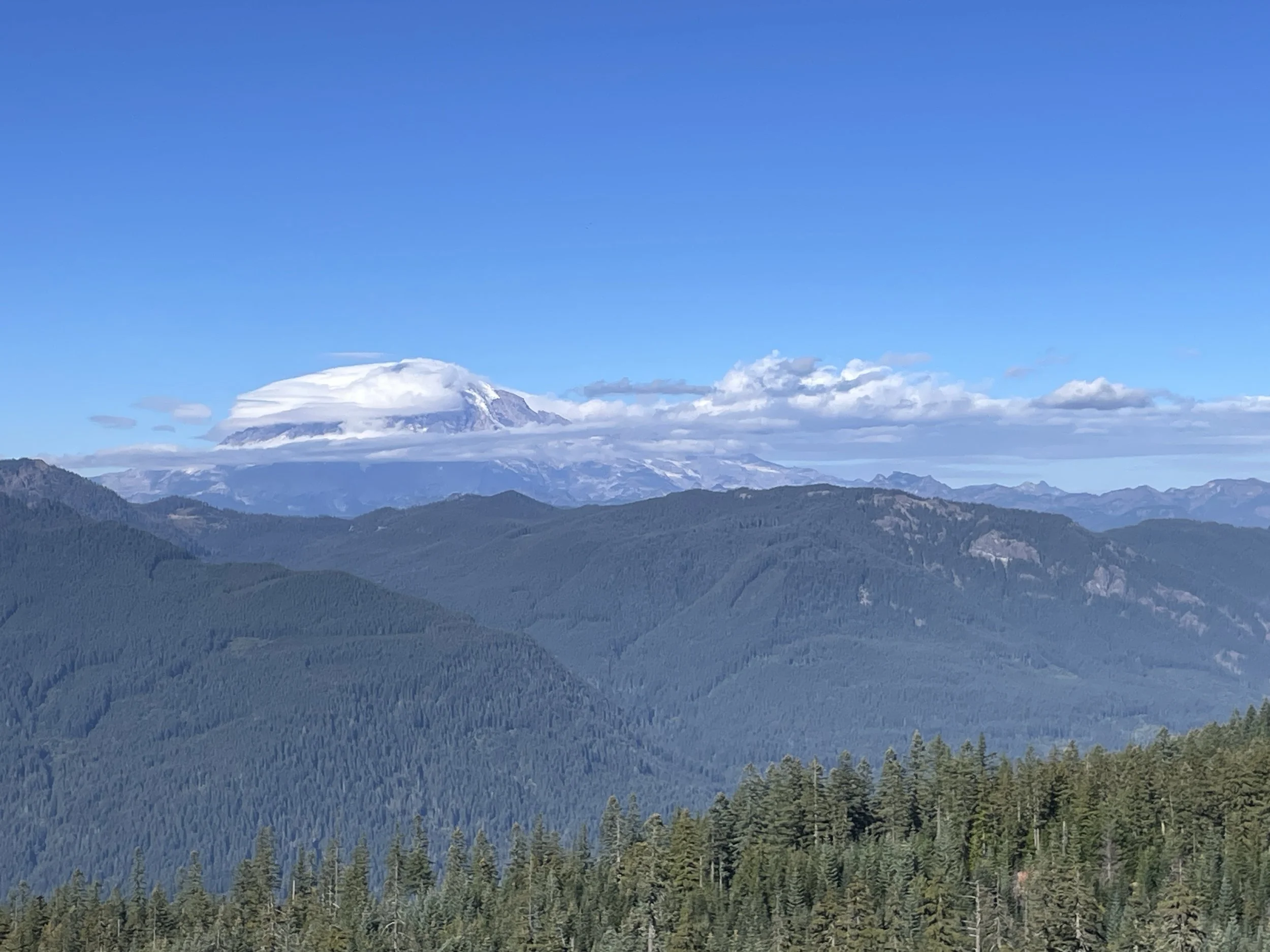 Image 17 of 31
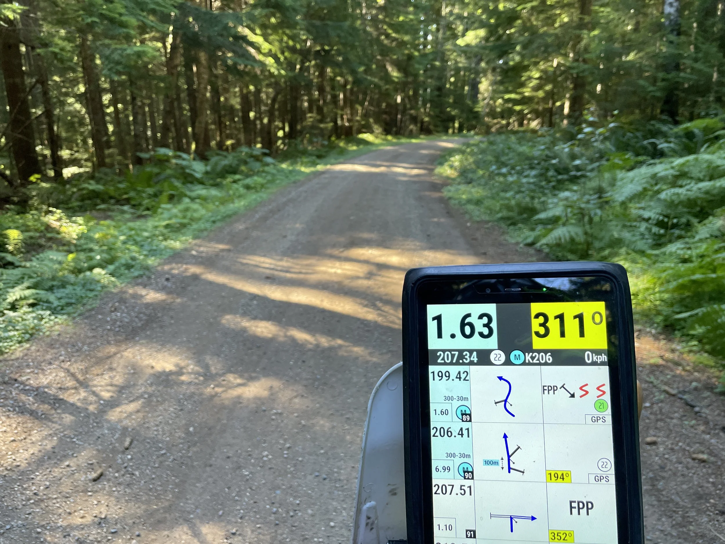 Image 18 of 31
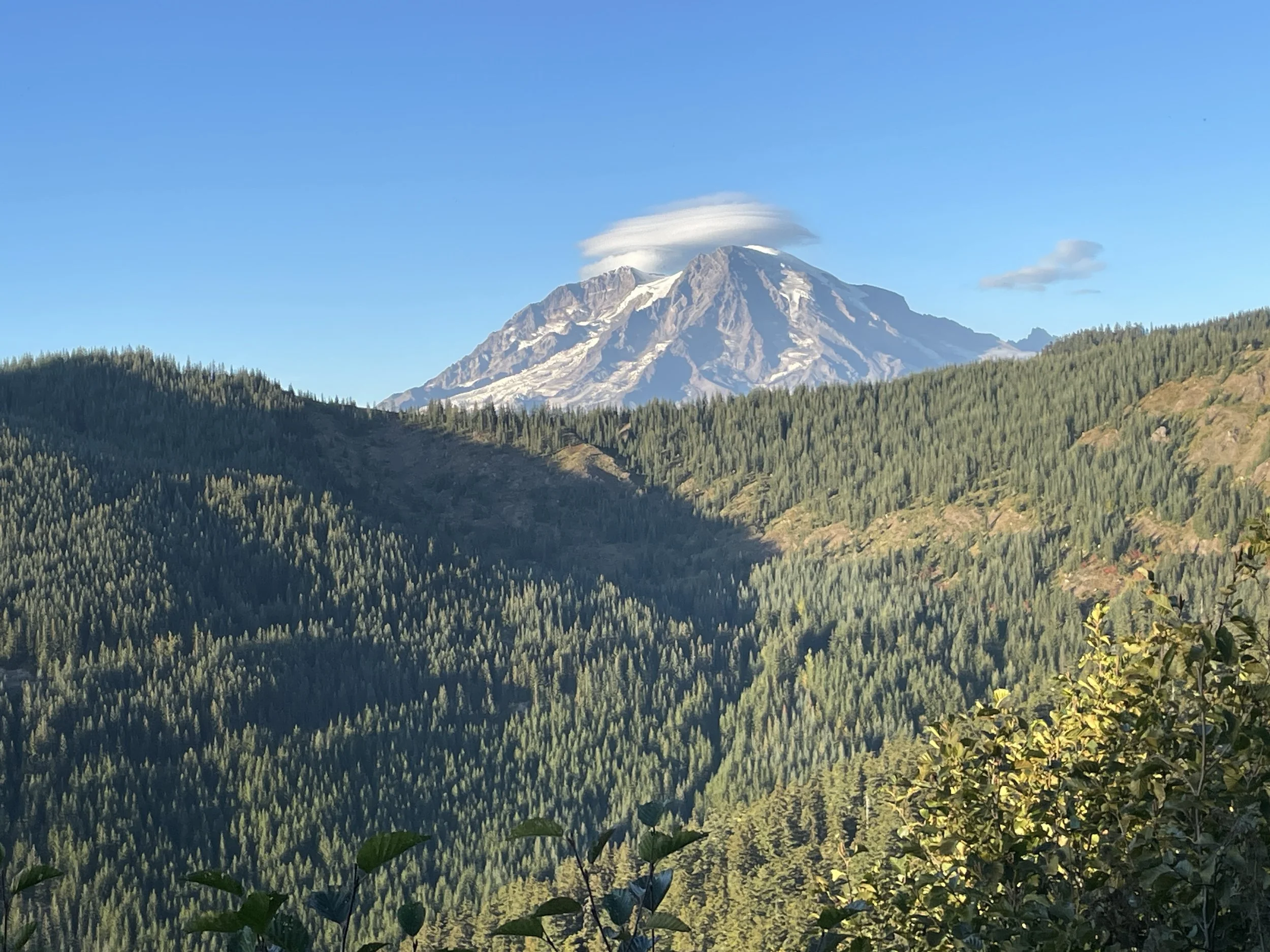 Image 19 of 31
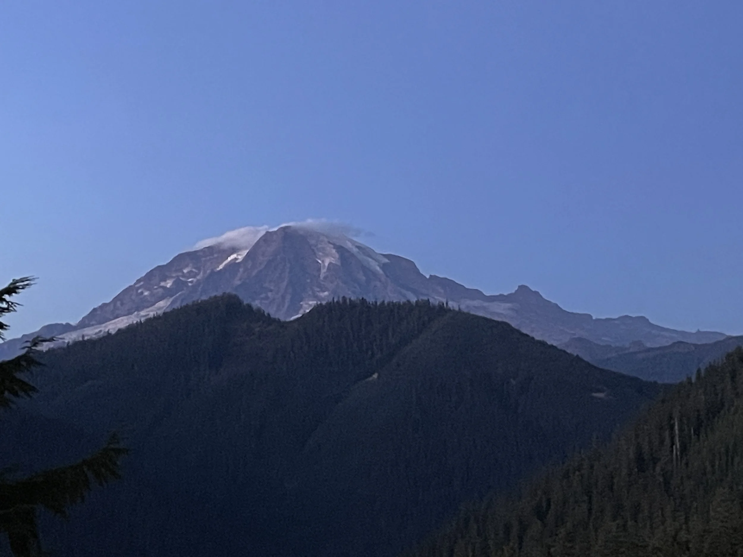 Image 20 of 31
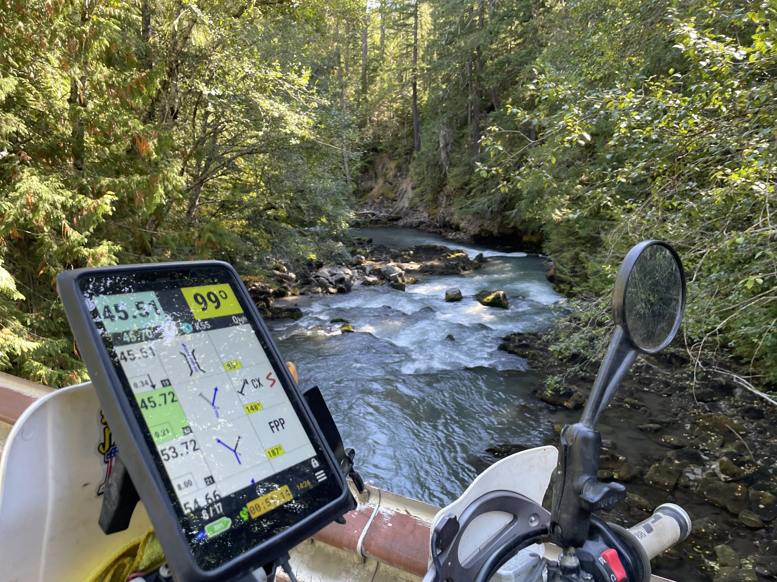 Image 21 of 31
 Image 22 of 31
 Image 23 of 31
 Image 24 of 31
 Image 25 of 31
 Image 26 of 31
 Image 27 of 31
 Image 28 of 31
 Image 29 of 31
 Image 30 of 31
 Image 31 of 31